Around the Coast Mountains
Welcome to the blog for my expedition of discovery around BC’s Coast Mountains. I’m taking this trip to satisfy a dream I’ve had most of my life to immerse myself in the nature of my home, the northwest coast of North America. I also want to make a nature documentary about this region.
The Coast Mountains region supports a wide diversity of ecosystems and landscapes because of its varied geography and the meeting of a moist maritime climate from the west with a polar continental climate from the east. All along the length of our left hand border, the coastal areas are divided from the interior by a continuous and almost impenetrable mountain range. Few roads cross it. Only ten rivers manage to cut through it. What binds it all together is the forests, the wildlife and the waterways.

The 10 BC rivers that flow through the Coast Range
What makes these ten rivers special is that they begin in relatively “flat” terrain in the interior, to the east of the mountains. As they flow westwards through the mountains, the terrain gets more dramatic and many of these rivers receive glaciers in their lower courses, rather than in their headwaters, which is the opposite of most rivers. This is due to the large snow catchment zones (and heavy precipitation) in the high elevations above which funnel ice down to the valley bottoms before it has a chance to melt.
With a burgeoning population and increased demand for natural resources, the ecological integrity of this region is also under continued threat. We do have many great protected areas here to enjoy and take care of, for which we have the hard work of previous conservationists to thank, but this system is incomplete. British Columbia and Canada do not have a comprehensive set of protected areas sufficient to maintain dynamic ecosystems with healthy and diverse populations of apex mammals. There still remains much pristine unprotected and threatened wilderness, and it is as important now as it has ever been that what is at stake be brought forward to the people of Canada and the World.
The first part of my trip in 2010 was a kayak journey up the Inside Passage from Richmond, BC to Prince Rupert, BC. Places I was particularly looking forward to visiting are:
- Long Lake and Smith Inlet behind Cape Caution (nice grizzly habitat),
- Hakai Recreation Area with its myriad inlets and islets meeting the open ocean,
- Princess Royal Island and Helmcken Lake (white kermode bears and healthy wolf populations),
- Quaal and Ecstall Rivers (two separate rivers which almost meet up, making for a spectacular river journey through the mountains west of Kitimat),
- the mouth of the Stikine River, and nearby Shakes Lake with its tidewater glacier.
Unfortunately I only made it halfway in 2010, which was still quite a trip though! In 2011 and 2012 I could only get a few weeks off from work, so I did short sections and made it to Bella Bella by then end of the 2012 season. Eventually I’ll get to Prince Rupert and start the bike ride back down the other side. On this part of the trip I will ride the backroads and wilderness trails along the eastern side of the mountains through the Chilcotin to discover the forests, lakes, rivers, history, and people living sustainably in this region.
The year after that, I plan to do the Alaska leg, with a kayak journey up the coast from Prince Rupert to Skagway and a bike ride back down the other side along the Cassiar Highway. I also plan to make a descent of the Taku River from Atlin. The Taku is one of the last remaining unprotected wild rivers in BC. It is a large river that empties into the Pacific near Juneau, the capital of Alaska. Amazingly, this valley remains unroaded. This probably has a lot to do with the large tidewater glacier at its mouth which would cut off road access. It supports large runs of salmon and is important for local fisheries and wildlife.
Here is a table of contents for the trip:
2012:
Rivers Inlet to Bella Bella
Aug 31 to Sept 1 2012 — To Shearwater and Port Hardy
Aug 30 2012 — Nice Weather into Bella Bella
Aug 28 2012 — Disoriented in Hakai
Aug 27 2012 — Calvert Island to Sterling Island, and sea otters too.
Aug 26 2012 — Hakai Beach Institute
Aug 25 2012 — Across Fitz Hugh Sound to Hecate Island
August 24 2012 — Spending the Day in the Koeye Estuary
August 23 2012 — Day Off in the Rain at Koeye
Aug 22 2012 — Blair Island to Koeye
Aug 21 2012 — North From Penrose
Aug 20 2012 — Flying Back In to Duncanby
2011:
Mereworth Sound to Rivers Inlet
July 17 – Around to Rivers Inlet and Out
July 16 – Taking a Break on Brown Island
July 15 – To the Edge of the Continent
July 13 & 14 – The Weather Gets Wet(ter)
July 12 – Heading Back Out Smith Inlet
July 11 – Touring Grizzly Bear (Habitat)
July 10 – Heading Up Smith Inlet
July 7 – Seeing Long Lake for the First Time
July 6 – Across Wyclese Lagoon
July 5 – Portage to Wyclese Day 2
July 4 – Portage to Wyclese Day 1
July 3 – Flying Out to Mereworth
2010:
Telegraph Cove to Port Hardy
August 5 – Across Queen Charlotte Strait to Port Hardy
August 4 – Back Out Nakwakto Narrows into the Unknown
August 3 – Backtracking out Belize Inlet
July 31 to August 2 – Bushwhack
July 30 – To the End of Belize Inlet and the Bushwhack
July 29 – Running Nakwakto Rapids and up Belize Inlet
July 28 – Shelter Bay to Nakwakto Narrows
July 27 – Day off in Shelter Bay
July 26 – Getting to Shelter Bay before the Winds Picked Up
July 23 – Big Miles by Broughton Island
July 21 – Marbled Murrelets and a Tanner Crab
July 19 – Leaving Telegraph Cove
Richmond to Telegraph Cove
July 18 – Sayward to Telegraph Cove
Powell River to Desolation Sound
Thormanby Island to Nelson Island
Roberts Creek to Thormanby Island
Day 2 – Earth Day – The Adventure Continues
Day 1 – Richmond, BC to Vancouver, BC
Here are some of my favourite / most memorable photos from the trip so far:

Yikes


Now for a clam


Belted kingfisher

Nodding onion

Crossing Desolation Sound to Tenedos Bay

Vermillion star


Evening light on the cedars at Unwin Lake


The pub at Shoal Bay

Landing on the windy bear beach

Bull kelp and waves


Looking south-east down Johnstone Strait


Pebble rubbing beach in Robson Bight

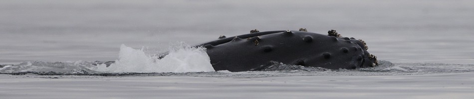
Mother and calf


Nice Job, GREAT pics. What an experience!!!!!! I believe a trip like this is priceless!!!!
February 22, 2011 at 12:40 pm
beautiful and inspiring photographs!!
March 1, 2011 at 7:56 am
Wonderful!!!
Jim
Toronto
March 1, 2011 at 3:28 pm
fantastic. well done.
March 1, 2011 at 4:35 pm
Your pictures are exquisite. I love them. I remember a trip to BC back in ’85.
I am a doctoral student at Regent University here in Virginia, USA. I use a good deal of photography from the north west in my presentations. These are not commercial and not sold in any way. I would love to have your permission to use some of your pictures. I believe that we on the east coast need to understand the ecology of the northwest in whatever way we may be able to contribute. I will give you full acknowledgement.
Please let me know if you give me permission. The pictures really tell a wonderful story, as well as how vulnerable this area is.
Blessings, Nancy Best
March 1, 2011 at 7:25 pm
Thanks Nancy, that should be fine as long as credit is given.
March 4, 2011 at 5:02 am
Great shots, you came across a lot of wildlife.
March 1, 2011 at 9:15 pm
I too would like to use two of your shots in an ebook on the Marbled Murrelet, a species I worked on for 15 years. One picture appears above – mamu with a ball of sand lance. The other was just sand lance breaking the surface but I don’t see it any more.
I have to recover costs so the ebook will be $5 – so I’d be happy to pay for permission
December 9, 2011 at 10:53 pm
Hi Gary,
Wow that’s great. Yes you can use it. I have some more photos in the series and I was shooting raw so I have better quality which could be better tweaked for your application. I’ll put the rest of the series on my Flickr site for you to look at. I’ll let you know when I get that up. Regarding payment, do you mean you’d pay me $5 to use the image? I don’t care about the money, but it would mean I actually sold one of my images, which is a milestone for any photographer, so maybe I will accept payment!
Mark
December 11, 2011 at 1:55 am
Stunning photography!
Your quest reminds me of this great blog: http://www.groundtruthtrekking.org/
Cheers from Sunny Seattle,
DA
December 13, 2011 at 8:43 pm
Hi Derik, thanks! I saw their website a while ago but the movie wasn’t out then, maybe I’ll get it. I am really hoping to get out again next summer but it is so busy at work right now, it’s hard to imagine how. I spoke with a guy working in the Alberta oil patch today and it is unbelievable how busy it is over there. No vacation time, no Saturdays off for months. Orders on mining trucks backed up for years, salesmen earning half a million dollars a year, young engineers like me earning 2 or 3 hundred thousand a year. That’s Peak Oil for you!
December 14, 2011 at 5:35 am
Take the money while it lasts. Live life, and don’t worry too much about the future!
December 14, 2011 at 5:55 am
Just want to thank you for the writing and images. I have enjoyed learning more about this beautiful and very special part of the world. You do a wonderful job!
February 22, 2013 at 2:51 pm