Snowbiking The Callaghan, Whistler
Since my last bikepacking trip up Cloudburst Mountain was so much fun I was itching to get out and try it again. That was a circle route up over the pass and back around the mountain. So I spent some more time poring over Google Earth and found out that there aren’t a whole lot of other opportunities like that for circle routes in that area because most mountains are just too tall.
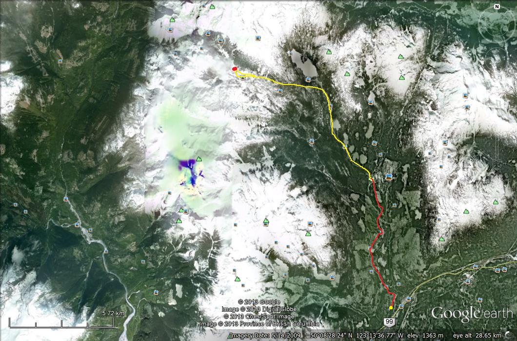
I went to MEC to get some real maps and discovered that there is a route leading from the Callaghan Valley (near Whistler) that goes west over a pass by Ring Lake and then down logging roads into the Squamish Valley. Great, I’ll just have to wait until August…
But … I just got my snow bike… so I can handle some snow. It won’t do powder but packed trails are OK. And I also have snowshoes, and a new packraft. So I decided to plan an adventure for March instead. My hope was that if the skies were clear the snow would be crusty enough that I could ride my bike over the pass if I got up early in the morning before it started to thaw. That’s super simple to do and I could easily cover 20 km a day if it’s crusty.
(I was planning to make a movie of this trip instead of a writeup but it just takes too long with the free Windows Movie Maker software. So I’ll just post some raw footage here; otherwise I’d never get it done. I don’t even have time to sort out the videos right now, actually. I have other posts that I want to focus my time on so I’ll just leave space here for them and add at a later time.)
I was super stoked to be trying out my new gear. My three day weekend of March 22 was coming up fast and the weather forecast was for glorious sunshine the whole weekend. I spent all my spare time the previous week working fast and furiously to get the kit together. It’s amazing how much stuff there was to do and I couldn’t possibly manage to get out of the house until late Friday morning.

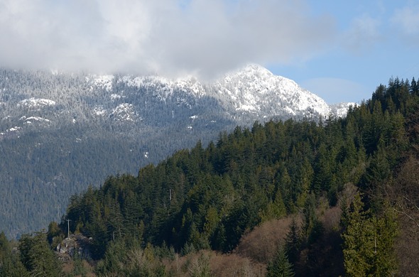
Fresh powder across from Brittania Beach
..

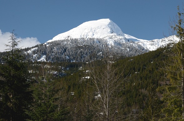
A little further along, coming into Squamish and this view of Mount Garibaldi

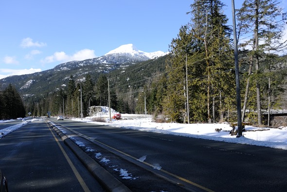
Above the highway, looking back down the Cheakamus Valley towards Squamish and Vancouver. The Squamish Valley merges from the right just over that hill. I was hoping to end the circle tour by packrafting down the Squamish to where you’re looking, and riding my bike back up the Cheakamus below to further up the valley where I’d park my car.
Video at rest stop.
I’ve never been to the Callaghan Valley before, which is an outdoor recreation area. It has the ski jump from the 2010 Winter Olympics, which apparently rarely gets used now. They punched a paved road way up the valley for that, which makes access easier, but at the same time just constitutes more “development” of our remaining wild areas. When will it stop? When will Whistler stop growing?

That’s Cloudburst Mountain! That I never actually saw last time when I circumnavigated it.
..
Tired of looking at Cloudburst Mountain yet?

I ended up parking in a big lot at the valley bottom, beside the Whistler garbage transfer station, that snowmobilers use. The guy charged me $10 for two nights, half the normal rate for snowmobilers because I wasn’t snowmobiling. Finding overnight parking up the Callaghan Valley is particularly tough apparently, especially in winter.
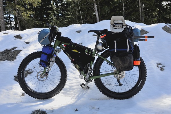
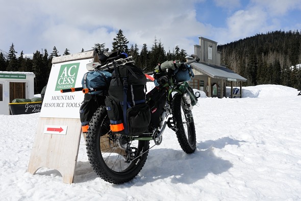
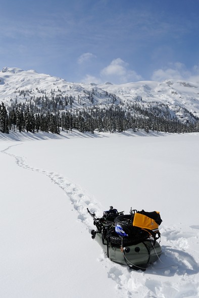
Ready to go on my first winter bikepacking trip.
I headed up the 8 km paved road, starting at 500 m and finishing at the cross country ski area an hour and a half later, up at 800 m.
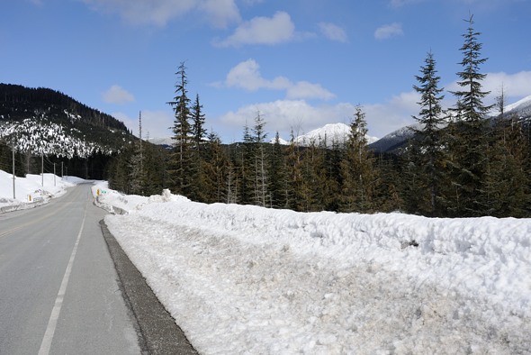
Looking up the road. It was fairly busy.
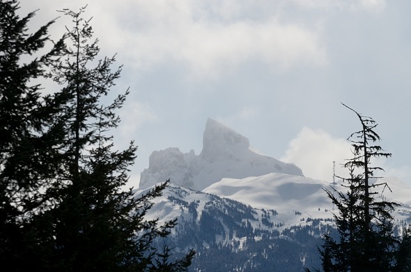
Looking back across the Cheakamus to the ever watchful Black Tusk (2400 m) towering over the whole area.
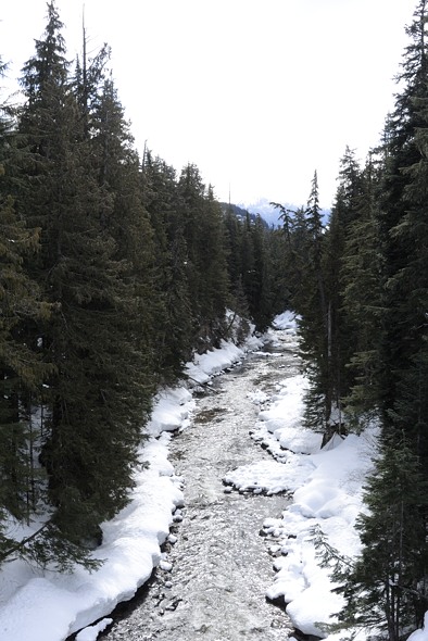
The road crosses the Callaghan River.
I had called earlier to confirm if I could come up and Kim came out to see me as soon as she saw I was there. They were a bit worried when I told them of my plans, especially since I had no compass (don’t need one) or map (all in my head). I had my Spot GPS though in case of emergency.
I set off up the hills and found it surprisingly easy to chug up the groomed runs. I did the grind for a few hours as I ascended the valley.
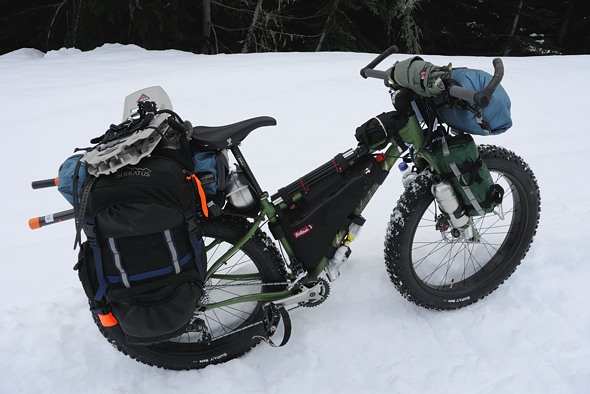
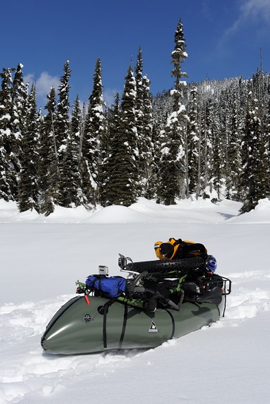
Handlebars: small sleeping bag, rain jacket
Front fork: water on right, alcohol on left. Thermarest on right in green sack, some freeze dried dinners on left in blue sack. GoPro video camera mounted above front wheel looking forward.
Top tube: Zip Shot tripod velcro strapped to the tube for quick removal, and rain pants strapped up front.
Under down tube: tire pump, and GoPro camera looking forward behind front wheel.
Frame bag: cell phone, food, tools, water filter, a few clothes.
Rear rack: packraft in blue sack, paddle shafts, snowshoes, cookset against seat tube, and bear spray wedged in there for quick access.
Panniers: one contains winter sleeping bag, other one contains my too-large tent and more clothes. Various remaining knicknacks throughout as well. Each contained one paddle blade.

Up and up…

I was running low on water but there were a few groundwater / meltwater streams beside the road which I could use to fill my bottles, without having to filter.
video

..

I could hear a helicopter flying back country skiers in to the mountains across the valley.

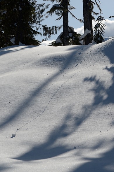
Back country skier tracks

..

Snowmobiler tracks. There are actually two black dots in there (top, left of center) which are the snowmobilers.

The valley beckoned.
I was heading up the Callaghan Mainline (gravel road), which is a cross country ski and access trail in winter. After reaching Callaghan Lake I headed left to go towards Callaghan Lodge.

On the way there I passed some guests from the lodge coming down the access road I was climbing. They were all very interested in my bike. For once, I was the tourist attraction. That’s not me.
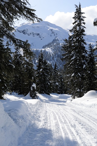
I was hoping the trail would flatten out after Callaghan Lake, which it did for a short while, but then it started climbing for a few more kilometers.
The snow was kind of melting down at the bottom but at the top it was still fresh powder. It wasn’t crusty.

Riding these kinds of trails requires active thermal management. As the saying goes for winter travel, “If you sweat, you die”, so I was pulling layers off to stay cool when climbing. But then if I’d have a downhill section I’d have to put them back on.
My plan was to go as far as the trails would take me and then snowshoe a little further, camp, and continue on over the pass the next day. I’d packraft down the Squamish, then ride back up to the car.
But at the end of Day 1 I was totally beat. Past the lodge the trail got progressively worse. Four hours of hard climbing was taking its toll on me. I normally do the Grouse Grind in Vancouver quite often which is great training for high intensity climbing, but it only lasts 45 minutes or so. Plus I was up at 1300 m now, which is beyond where I normally train, so I could feel the altitude.
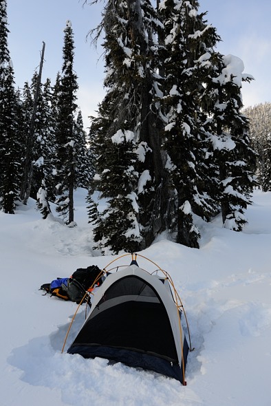
I basically got to the end of the trail and crashed, and set up camp 20 feet beyond…

Paul at work told me a trick to avoid soaking your boots from the snow — wrap them in plastic bags. This worked reasonably well but some snow still got in there. The plastic was pretty thin and some holes developed.

That was it for the day.

View from my tent
It was getting cold too — minus 5 or so, and dropping fast as the sun went behind the mountains. Luckily I had been winter camping before and learned a few lessons … like, don’t leave your wet boots out when it gets to minus 20 C…
I didn’t make that mistake again but I discovered a few more complications to camping in sub zero weather. Firstly, my alcohol stove was hard to get going at -5. I should have put the alcohol in my pants to warm it up first. Secondly, it’s kind of hard to wash your pots when the food crusties freeze solid in a few seconds. That takes some more planning, especially if you want to use that pot to melt snow for drinking water afterwards.

Another challenge I anticipated was that the stove would melt through the snow and collapse, so I cleverly brought along some tinfoil to place it on. But it was too thin and the stove still ended up tilting a bit. With all the snow melting, etc. I used about twice the alcohol I usually do.
I got my two sleeping bags set up, with my water bottle, water filter, alcohol, and boots in bed with me.
The other thing that happened was that I couldn’t curl up to stay warm because this caused leg cramps after all the hard work that day. I have to stretch out which means I get colder.

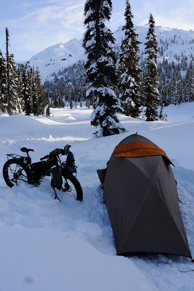
Ring Pass is thataway.
That night I spent a lot of time wondering if I should risk going over the pass or just head back down. My concern was that the snow went way down to 400 m, so I’d have a lot of downhill hiking through the snow on the other side, with sticks and twigs I’d have to pull my boat over. I’d see how my snowrafting went in the morning, then reassess.
It was a chilly night, probably down to minus 15, but I survived reasonably well. In the morning the trail groomer came by in his machine. I don’t think he was too happy with me camping right there beside the trail, but oh well, it’s public land. Skiers stopped and talked as they went by, and were quite interested and impressed. It’s not hard people, you just need the right gear!
I think snow biking will soon be taking off in Whistler. Years ago it was snowboarders invading the slopes and causing a caffuffle with skiers. Now I think it will be snowbikes to invade the ski slopes, causing a caffuffle with boarders and skiers. They can put them on the chairlifts in summer, so why not in winter too?

Morning flurries
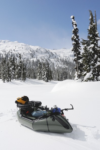
Video of snowrafting.

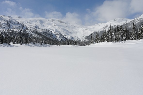
Conflict Lake is quite scenic. Until I traipsed across it with my snowraft, that is…
..

It’s pretty hard to pull through the snow. I think that’s because of the rubber bottom material which isn’t very slippery. I will try to find some more slidy material to put underneath for pulling across the snow.

That’s Ring Pass, right of center.
..
After a kilometer around one side of Conflict Lake I’d had enough and rejoined the cross country ski trail to flip back over to my bike again.
..

Doing the switcheroo in the blazing sunlight and strong winds, and cold temperatures.

Above you can see the track the skiers used to climb up to the knoll on the right. And below this track you can see all their ski tracks when they carved their way back down. I’ve never done back country skiing, maybe I should try. No time though, or money. Too many other things to do.
Video of undulating trails.

Nice bike portrait in the forest on my way back down
Videos going back down.

..

Crossing Callaghan Creek the other way.

..

That’s it!
I decided to drive down to the Squamish Valley and sleep there in my car for the night. Tomorrow I’d ride up the valley and packraft back down what I was originally hoping to do all in one circuit from Ring Pass.

I was cold just looking at the pictures. 😉
BTW – the links to the videos didn’t work.
safe riding,
Vik
May 14, 2013 at 2:33 pm
Hey yah it sure was cold, and I’m skinny. I haven’t put up the videos yet, those are just place holders.
May 15, 2013 at 3:23 am