July 26 — Getting to Shelter Bay before the Winds Picked Up
As I presumed yesterday afternoon, the rocks were indeed covered in slippery intertidal life all the way down to the water. By 7 a.m. I was ready to go and started packing my stuff down to the water. I was able to negotiate the upper rocks without too much difficulty but then they became very slippery a little bit further down. This was potentially very dangerous since if I slipped and wedged my leg I could easily break a leg or twist an ankle.

Stunning coastal architecture
I put on my running shoes since my sandals were not going to cut it. I tried making a pathway out of medium sized beach logs taken from further up the beach. I would string these along in a line and try to walk on them whenever possible. This also presented danger if they were to shift while I walked on them. I would also try to walk on the occasional patch of barnacles because these provided great traction, but they were spotty.
One by one, I humped each of my loads and my boat down about 8 meters at a time. Eventually as I passed the very slippery mid level rocks they became a bit more negotiable, but not because they were less slippery, but instead because they were covered in so much sea weed that this held my feet in place.

I would have taken more interest in the rich intertidal life that was giving me such headaches but if I was going to make any decent time today I had to get moving soon; I couldn’t dilly dally or wait four hours for the tide to rise. I did take a picture of a blood star which feeds by absorbing the dissolved organic molecules and bits of stuff it comes across from the pea soup in which it lives, this emerald sea which is deep green from all the nutrients brought here from upwelling currents. These nutrients feed the vast kelp beds which have been a dominant part of the ecosystem on my trip so far.

Finally, after about an hour, I got all my stuff down the twenty meters to the water and started to load my boat. But I couldn’t load it in the water because it got too deep around the rocks to easily walk around. I also didn’t want to get my shoes more wet. So instead I put the boat on my logs and loaded it there. I would slide and launch it off the logs. After one good soaker, I was ready to go.
My plan to slide my boat along the logs forgot to consider the skeg at the back end of the boat. So I had to lift up the heavy back end of the boat and then push. I did this a few times, repositioning the logs each time, and then it was in the water. Finally, I was off! But that has been the most physically difficult thing I have done on my trip so far.

I continued on up the coast in the typical calm winds and fog. After about five kilometers I passed by the official opening to Blunden Harbour. So I didn’t get as far yesterday as I had hoped I would. This opening is a tiny little waterway that cuts through the outer peninsula of Blunden Harbour, and is only accessible at high tide. It was dry now.

The first of three fish farms I would pass today


A little ways past this I went through a fairly narrow channel separating an island, and I had to really fight hard to get through the currents. I hopped from one sheltered spot to the next and got through. I then immediately started to feel more of the swell from the open ocean. I also at that point, not coincidentally, saw my first patch of Macrocystis kelp, which is different from the more common Nereocystis bull kelp that has been ever present on the entire length of my journey so far. Macrocystis needs the influence of the open ocean – the water movement and the more constant salinity. That is what it’s getting here. I have seen bits of it washed up previously, but not the actual plants themselves.
I also encountered another fish farm pen here, no doubt positioned to take advantage of the swift currents to carry away all the wastes. Other than the odd fish farm, there really is nothing in the way of human life up here. There is of course lots of logging just onshore but no permanent habitation.
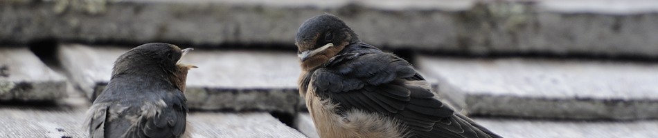
The waves generally got larger as I went along. I crossed a large bay and the bird life was quite impressive. There were auklets everywhere. This is what marine biodiversity could and should be.

Rhinoceros auklets
I had a GPS coordinate for Shelter Bay, my destination for the day. I had no map of this particular stretch of coastline. Yes, that’s right, I had no map, except an extremely crude cartoon drawing from a tourism brochure which basically shows this coast as a straight line. I didn’t think I’d need one since it is fairly straight forward – you just keep going along the coast. So I didn’t print one off. That’s what I was doing though – following the coast. But there were more bays and islands than I wasexpecting and this was throwing me off a bit. I was counting down the distance to Shelter Bay and it was still a good 5 km away.
I came to another set of islands and noticed quite a few sport fishing boats around, presumably across from Port Hardy. The currents were pushing really strong against me. The place had a different feel; it suddenly seemed more exposed and raw. I fought my way up through some channels and then I saw another little cheater channel off to the side of one. I pushed through the current and was then immediately in calm water. I could see that this led into some more rough water. When I got out of this I was fighting the wind, waves, and currents and I made a dash across to the next little island.


After this I had to cross another open bay to get to the mainland again. This proved to be quite rough, actually very rough. It was north-facing, exposed to the open water, and the bathymetry of the bay was making some very large swells, like about two meters, which is large for my boat. I would have put on the video but it was too rough. I fought my way across and kept going up the coast past the large breaking waves. This was rough water. I was getting concerned. I was praying that the winds would not pick up because I could be in trouble. I also wished I had put on my drysuit today. I was glued to my GPS. How could it be so far to Shelter Bay? The meters were creeping by and I cursed my slow progress. I looked to the trees to confirm that I was moving but it seemed to take ages.


Finally I came to a sheltered bay and the winds were picking up. I saw that the peninsula forming the outer edge of the main bay went a little further up, but I really did not want to round that point since it would surely be very rough! Hopefully this little bay led to a shortcut into the main bay and it did. I also smelled rancid fish. As I entered the main bay I passed by an empty floating farm pen. My GPS said that Shelter Bay was still a kilometer away. I had to cross this north facing bay to get to it, and the winds were really picking up now. I started to cross, with the gloomy and muted greys of the ocean fog to the left contrasting the clearing skies to the right, inland just above the trees with brilliant sunshine and pastel greens. I could even see the mountains through which I would be paddling over the next few days.

The cheater channel through to the larger bay


Gloomy fog to the west

That is the point I was glad I didn’t have to round
Once across the bay I took a rest in the lee of a little island and then pushed the final leg upwind to Shelter Bay. It was like a mirage, with its glistening sand beach shining in the sun.

Glorious sunshine to the east

That’s the Shelter Bay beach!
I landed and hiked my stuff up to the nice campsite. It is really nice here with flat soft tent sites and a large rope for a bear cache.


I also noticed a sign warning of a cougar in the area. And after setting up my tent I noticed a tuft of tan coloured hair beside it. Some parks people had recently been here doing some maintenance and putting up the sign, so I assumed they had brought a dog with them. Sure….


That’s dog hair beside my tent. Sure….
Tonight’s dinner was another round of Mediterranean Pasta with those brown chunks of meat-like things. I normally have a two-servings portion along with additional rice or plain pasta to add volume. I also add some spices like cayenne pepper, onions, garlic powder, or oregano and basil. I cook it until it is pasty, then add cold water which not only cools it down quickly, but turns it into stew. I like this and it fills me up well. But I am always hungry regardless. Today I thought I would up the ante a bit and make up four servings instead because I had worked so hard. I could eat more of it later.
So I cooked this up but the problem was that it filled the pot, so afterwards I couldn’t add the cold water. This meant it had a thick consistency and the sauce was very strong with all the spices I added. This was too much and I quickly lost my appetite. I just couldn’t eat more than half of it. I felt bloated for the rest of the evening and the only responsible thing to do was waste a good portion of the dinner by throwing it in the ocean because otherwise it would attract bears. Oh well, one dinner wasted; live and learn. Also, I checked the ingredients on the pasta and those brown things were actually some kind of processed soy product. They tasted good though normally, just not tonight.
Now somehow I had managed to convince myself that the tuft of hair beside my tent was from a dog. Obviously it was from a cougar. But I was still paranoid about animals crashing my tent at night so I did something I had been wanting to for a while. The problem is if a bear crashes the tent I won’t be able to get out in time because I wouldn’t be able to pull the zippers in all the caffuffle. So I got some pink ribbon from the little creek in the next cove over, which the parks people had used to mark its location for campers to access water (I took it off the ground), and then attached this to the one zipper that I should pull down vertically in an emergency. Then I would position this in a location where I could easily grab it in an instant if necessary. I would also sleep with my knife handy in case I needed it to cut the mesh. Of course I slept with my bear spray.
That night I did not sleep well. I was bloated and at midnight the tide came up. With the higher tide the waves were not broken by the bay floor and they were large and noisy. These waves were bouncing off the far end of the bay. When they hit the logs at the top of the beach they make strange sounds that can sound surprisingly similar to a bear growling. Just listen to them nonstop only 20 feet from your tent for four hours at midnight…
I wasn’t worried about cougars while in my tent though because they wouldn’t bother me there, but it would present no barrier to a bear.


Leave a comment