Latest

Bridge River Recon Part 3 — Chilcotin Mountains Park

The next morning I went into Gold Bridge.

DSC_4744_000

The east end of Downton Lake at the dam

There is only one store in town, which was closed for restocking. I wanted some gas and apparently the other small town of Bralorne, 10 km up the hill to the south, had some.

DSC_4770_002

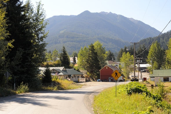
I went up there but there was no one around, so I went back down, having used up some gas unnecessarily. But Bralorne is an interesting little mining / tourism town. Mountain biking is big here.

DSC_4765_001

Apparently they produce a kg brick every few weeks.

I decided I’d spend a night or two up in Chilcotin Mountains Park above Gun Lake.

1 DSC_4772_000

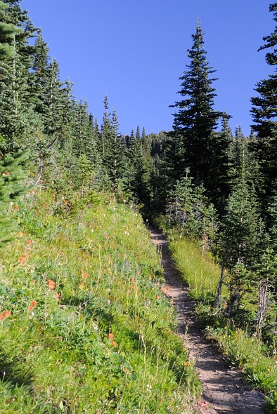
Ready to head out. The insane flies sure helped the motivation to get moving. I saw on the map that the Lick Creek Trail went up into the mountains in a fairly straightforward path.

2 DSC_6450_025

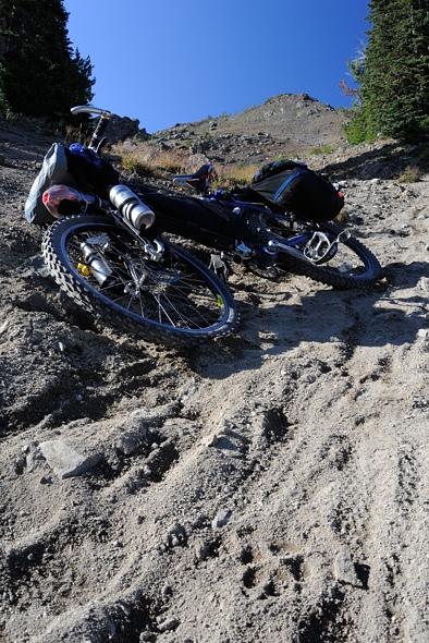
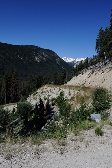
I soon discovered that it was a short distance on the map for a reason — it was super steep!

3 DSC_4775_001

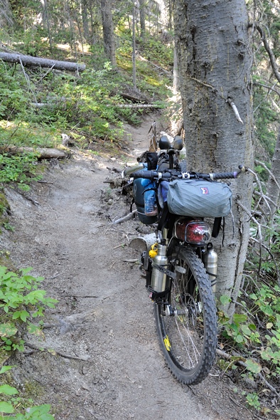
I pushed and pushed and pushed, huffed and puffed, uttered a few curses, strained and grunted and forced my bike up and over each obstacle. The trail was narrow, rutted, loose, and very steep — I guess that’s why it’s such a highly rated downhill ride. I passed one group of bikers heading down. I asked how far it was — I was barely a quarter of the way up. They were incredulous, as was I.

4 DSC_4777_002

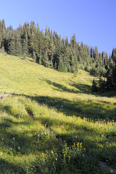
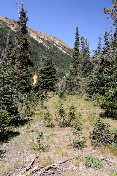
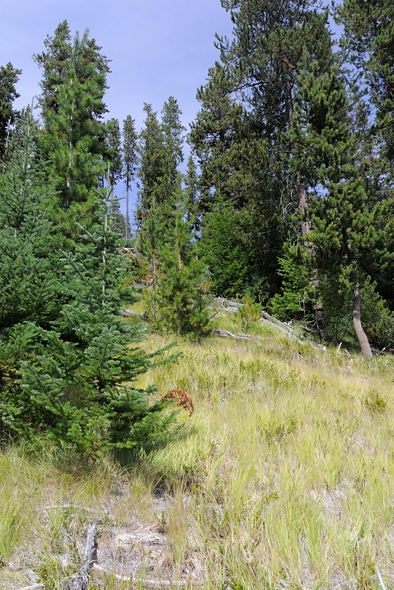
Finally near the Lick Creek headwaters it levelled off a bit in this interesting yellow lichen-encrusted forest.

5 DSC_4779_003

I set my tent up here. Man, I have to say, that was the second most physically gruelling thing I have done in my life. I pulled my loaded bike up 900 m to 1920 m elevation, but the trail was so unbelievably steep I had to do the last 300 m of the climb twice — once with just my heavy gear, and once again with my bike and remaining gear. So I did 1200 m. I am so glad to have my body back.

6 DSC_6467_026

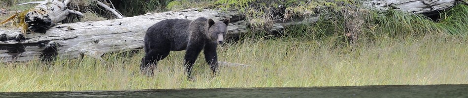
While in my tent eating dinner, I heard a large mammal outside.

7 DSC_6472_027

..

8 DSC_6479_001_005

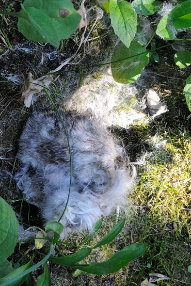
While doing the final packing of my bike next morning, I happened to scan up and this funny-shaped tree stump caught my eye… He didn’t seem to be at all bothered by me. He just watched. Maybe he was following the deer that went by last night. It’s at times like this that I wish I had brought my dedicated wildlife lens, not the mid-telephoto zoom.

9 DSC_4783_005

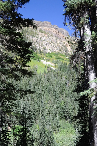
I was packing up in the lower meadow in the centre, and the wolf was watching me from another meadow behind the trees on the very left. Also, you can’t really see it because it’s blown out, but there was a forest fire on the other side of the valley there.

10 DSC_4781_004

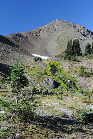
Another 150 m of climbing was in order for this morning to get over the pass into the next valley.

11 DSC_4785_006

..

12 DSC_4788_007

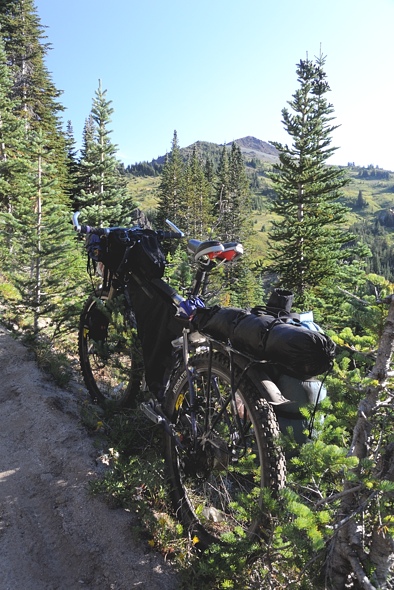
I had to take my pedals off, which really helped on the narrow trail. I was back to doing two loads…

13 DSC_4794_008

Amazingly, someone even brought a horse up here.

14 DSC_4795_009

From whence I came

15 DSC_4807_010

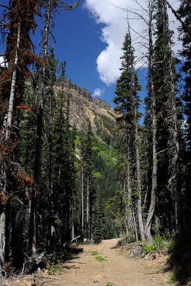
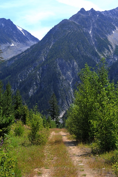
Finally, over the pass at 2050 m, looking down into the next valley I would descend a little ways into, then meet up with another trail heading right (east) up and out again over into the Pearson Valley.

I have quite a bit of video of the rest of the ride which I’ll add soon, but right now I have some more pressing things to sort out … details to come.

16 DSC_4809_011

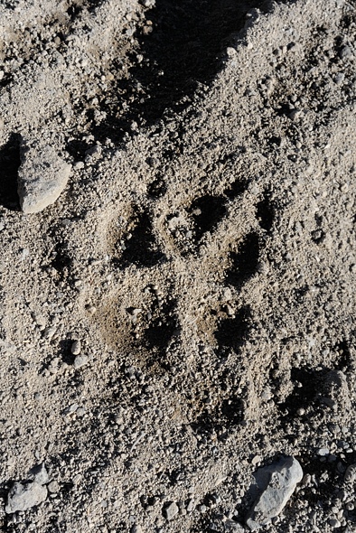
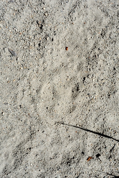
My wolf friend was also using this trail.

17 DSC_4810_012

It was a shame I had to ride over his tracks but I had to move too.

18 DSC_4811_013

..

19 DSC_4818_014

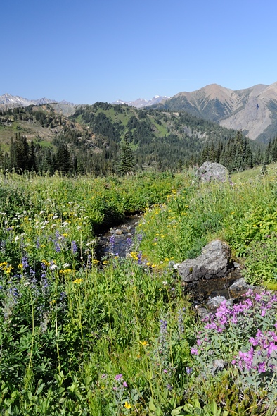
The meadows going up over the pass to Pearson Creek were like paradise … except for the man-eating bugs.

20 DSC_4819_015

..

21 DSC_6504_029

..

22 DSC_6526_030

..

23 DSC_6537_031

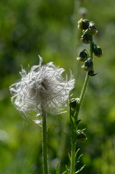
At the time I didn’t appreciate it, because I was being eaten alive, but each of the alpine flowers had a whole community of insects associated with it. This place was like that wonderland you read about in ecology textbooks, with sunshine filtering through colourful meadow flowers, and all the birds and bees associated with them.

24 DSC_6545_032

..

25 DSC_6553_033

..

26 DSC_4822_016

Looking back at another 150 m of climbing to regain the elevation I had lost.

27 DSC_4827_017

Finally … lunch at the pass, and High Trail going down Pearson Creek.

28 DSC_6564_034

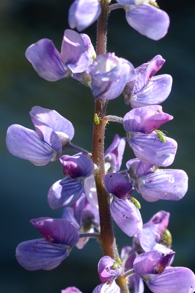
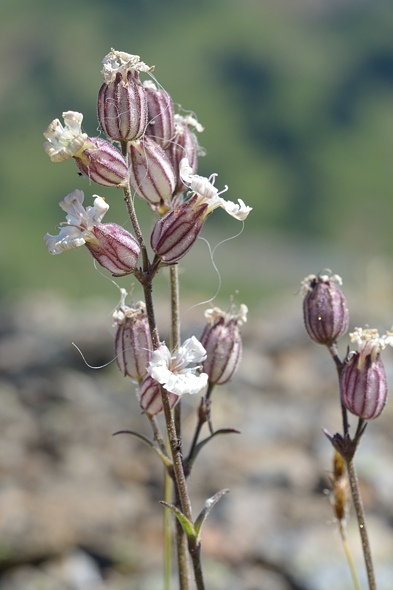
These little flowers have delicate colour patterns on their petals. You just don’t notice all the intricacies going on until you review the macro shots later. That’s a good lesson I think, to stop and smell the flowers in life. There’s lots more going on around you than you may realize.
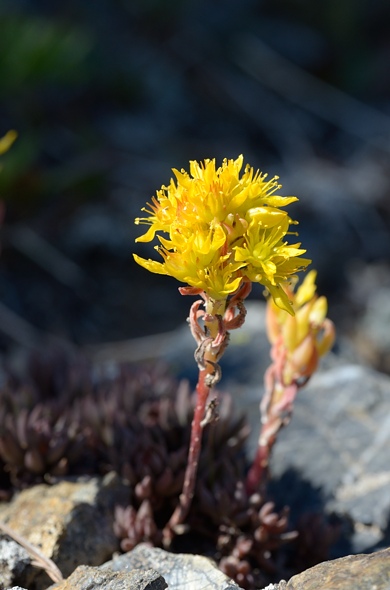
29 DSC_6573_035

Stonecrop

30 DSC_6575_036

..

31 DSC_4829_018

I had 1000 m of descent ahead of me.

32 DSC_6618_037

I passed a couple going up (look closely). They were going to go down Lick Creek trail. They were only up for the day, so much less heavily loaded than I was. Everyone up here is super fit; how else do you get up here?

34 DSC_4838_019

..

35 DSC_4841_020

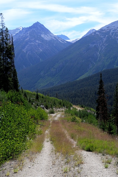
One of the more inviting trailheads I’ve come across in my tavels… but I was going down.

36 DSC_4842_021

Near the bottom of the hill, after all the mud and dust. That sure was a fun descent, but I screwed up my left thumb for a few weeks from all the braking I was doing. I loaded my bike too heavily; it was not performing as I would have liked. I passed another couple going up for a few days and I couldn’t believe how light their kit was. They had backpacks, and plus it helps to have two people, as much of the gear can be shared.

37 DSC_4850_022

I passed through more hot and dry grassy douglas fir stands.

38 DSC_4852_023

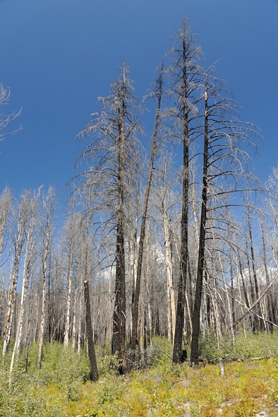
On the way driving back out, I went by this recent burn.

39 DSC_4854_024

All clean after my bath in Mowson Pond.

Bridge River Recon Part 2

Another day, another bike ride…

01-DSC_4506_000

I found this guy slithering down at the stream in the morning.

02-DSC_6333_032

I set off and soon came upon the first clearing and a deer. It had at least four sucking deer flies, two on its snout. Unfortunately for the deer, they can’t swat them off as easily as we can. Somehow they manage to survive without going crazy though. At least at night the flies go to sleep too. It didn’t take off so there must not be too many hunters up here.

03-DSC_4509_001

The road climbed up the north side of the valley. It was really hot in the blazing sun. But I knew that I only had about 400 m of climbing to do and it would only take a few hours so I plodded on. I was mostly pushing my bike.

04-DSC_4512_002

Then the character of the road changed. I was at the end of the forestry road and the beginning of the mining access road. It became narrower and more like a quad track, but still passable for a good 4X4 with a short wheelbase. That mountain is on the other side of the river I wanted to cross. I was actually hoping to get up on to the summit of that alpine plateau there, but I’d have to go way up the valley to get to terrain suitable to climb up.

05-DSC_4515_003

At the end of the road I found this!

06-DSC_4518_004

I’ll take it thanks!

07-DSC_4553_006

Here is a better view from the cabin, across the valley. The river is canyon-like here and too dangerous to cross. And there’s no way I’d be able to drag my gear up that slope. So I’d have to go up to the head of the valley where the river is flatter and the sidehill more gentle.

08-DSC_4550_005

A hundred meters past the cabin the road ends at a picturesque debris chute (which I didn’t take a picture of).

09-DSC_6348_034

The penstemon and lots of other flowers were in bloom. The river is glacier fed and silty and therefore not good for filtering as it would plug up the filter element. And it was cold too. But the little stream in the debris chute was clear and warm, not being glacier fed and tumbling down 500 m over black rocks roasting in the sun. It was warm enough that I could have a comfortable splash-bath.

10-DSC_6344_033

There are interesting hoodoos at the top of the debris chute. There are also some lakes above on the alpine plateau. That’s all whitebark pine at the higher levels. It grows thick here.

I decided to use the cabin as a home base to check out the valley. It was soon apparent that I wouldn’t be able to do my trip in the one week I had off, unfortunately. It would just be too hard to pull my bike up the valley. I thought the road went further up. Tomorrow I’d go hike up the valley to assess just how difficult it would be. So I spent the rest of the day R&Ring.

The flies are attracted to the heat so when I made dinner they were swarming all around and afterwards the stove was full of dead fly carcasses. It reminds me of a funny story from treeplanting in Alberta years ago. You’d think that being the foreman would be the best job — you don’t actually have to do any real work. It’s the planters who are out there grunting in the trenches. Well in northern Alberta our foreman whipped around on a quad checking everything out and hauling boxes of trees around. And of course, the horse flies and deer flies are attracted to heat and CO2 … both of which the quad was producing copious amounts of. So whenever he’d pull up he’d have this massive, I mean massive, cloud of horseflies following him and he couldn’t outrun them. It was pretty funny.

Anyhoo, that Thai Satay dinner was one of the best ones I’ve had in a while… everything seems to taste better when you are pushing hard and need the calories. It started to hit me how isolated I was. With the road closure I had the entire valley to myself. I was a good 60 km by road from the closest person, maybe 30 km as the crow flies if there were campers up in South Chilcotins Park to the north-east. It’s easy to write, “I was totally alone”, but a bit different to actually experience it. It wasn’t a bad feeling; just something I don’t often experience except on these little adventures I do. Few people get to experience that kind of isolation; it’s worthwhile to try to get it IMHO.

In the evening I lay down on my Thermarest on the plywood bed and listened to music on my iPhone. As it got dark I looked out the small window to vaguely see some stars poking through the trees. I wondered about what the chances were that those particular photons, merely a handful of the quadrillions of quadrillions produced by that star who knows how many light years away, happened to travel through so many unbelievably many kilometers, over such a long time, all the while ever-expanding and diluting in intensity to the square of the distance travelled, and somehow manage to get through the atmosphere, between the fir trees above the cabin, through the smudgy little window, and into my eyes and onto my retina, just at the moment I was thinking about them and looking. What journey must that be like from the photon’s perspective? Or is there such a thing as a photon’s perspective? Maybe that reality of the starlight making its way to my thoughts via my eyes only existed because my consciousness brought it into existence. If I wasn’t alive to observe it, was there even any starlight there to see? How is the star any different than me, if it’s all just “One”? I think I need to do some Buddhist practising out here on these trips…

And now back to “reality”:

11-DSC_4625_016

The next morning (well, more like lunch time) I hiked up the valley. There is a deer trail that is fairly easy to follow. Basically you keep as close to the edge of the river canyon as you can and you’ll find the trail if you lose it. I was encouraged to see that the terrain wasn’t all that difficult, except for a few tricky areas that wouldn’t be too much of a problem.

12-DSC_4556_007

The trail alternated between forested areas and open clearings like this.

13-DSC_4561_008 ..

14-DSC_4571_009

In places I would have been able to ride my bike.

15-DSC_4592_012

Stonecrop likes the dry areas.

16-DSC_4615_015

Looking across to the west side of the valley. That green meadow really is a meadow. It’s like your front lawn.

17-DSC_4583_011

The light green areas are the grassy meadows, easy to walk through. But these are interspersed with willow thickets that get up to head height, substantially more difficult to walk through. Not a problem if you’re just walking but pushing a bike would be a bit more of a challenge. But if you took your pedals off and turned your handlebars it should be do-able.

18-DSC_4581_010

Looking up to the head of the valley.

19-DSC_4594_013

The willow got thicker as I went further up the valley. I went about as far as I felt like going and did some more assessment of the hike up to the alpine. I’d cross the river around here on my packraft and then hike up through the forest at the far end. The willow looked thick, but at least it’s not spiny like devil’s club. The vegetation here is all pretty benign.

20-DSC_6371_035

I’d go through the forest and emerge in that meadow at the top left.

21-DSC_6391_036

The flies were driving me nuts but I took out my macro lens and managed to pull a few shots off. If I stayed still for more than five seconds they’d attack me.

And now, for your viewing pleasure, I have put together a video montage of my trip up the valley, including some narration from myself.

.. 22-DSC_4607_014 I hiked back down the deer trail to the cabin. One person with a saw and clippers could clear a nice trail up that valley in one day. I was disappointed that I couldn’t do my circuit, but what did I expect? I’d never been here before. This was a good scoping-out trip and if I had two weeks I would have been able to do it. Hopefully in September I might be able to get time off and do it then. Otherwise, next year.
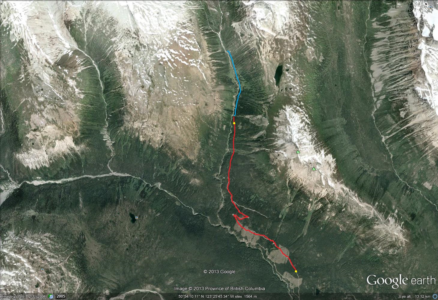
 Unnamed Valley ..

23-DSC_4637_017

The next morning I headed back down.

24-DSC_4643_018

I was going to try to get all the way back to the car. That was almost 50 km, with 1300 m of descent and 300 m of climbing.

25-DSC_6400_037

Looking back up to the upper Bridge River. There is a big icefield up there.

26-DSC_4659_019

At lower elevations I went through these nice grassy park-like lodgepole pine stands.

27-DSC_4665_020 ..

28-DSC_4683_021

Fresh wolf prints were left on my tire tracks from two days before. The grizzly tracks were gone, suggesting that when I saw them they were fresh. I felt like Mantracker, analysing all the tracks I was seeing.

29-DSC_4688_022

Looking back up the Bridge River. It was like paradise.

30-DSC_4694_023

There’s even some ponderosa pine here, which likes it hot and dry.

31-DSC_4701_024

This is western white pine.

32-DSC_6409_038

There’s lots of wildlife even up here at these higher elevations.

33-DSC_4706_025

At the Bridge River Bridge is this new building which seems to be some kind of a camp. I took refuge from the bugs there and had some peanut butter on mango.

34-DSC_4721_026

There were also some more bear tracks here, but this time going my direction so I was coming up behind him. They weren’t very big though.

35-DSC_4731_027 .. 36-DSC_6439_039 It was a long day but the kilometer countdown to the car kept me going.

37-DSC_4733_028

Finally I got to Jamie Creek.

38-DSC_4734_029

Big steel pipe with 1 inch thick walls.

39-DSC_4735_030

I made it back!

40-DSC_4740_031

Right across the road was some seepage where I could fill my bottles without filtering.

Here is another video montage of the trip back down, including a demonstration of how to get your bike over a penstock.

..