Bridge River Recon Part 3 — Chilcotin Mountains Park
The next morning I went into Gold Bridge.

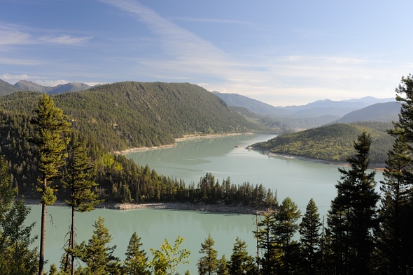
The east end of Downton Lake at the dam
There is only one store in town, which was closed for restocking. I wanted some gas and apparently the other small town of Bralorne, 10 km up the hill to the south, had some.
I went up there but there was no one around, so I went back down, having used up some gas unnecessarily. But Bralorne is an interesting little mining / tourism town. Mountain biking is big here.

Apparently they produce a kg brick every few weeks.
I decided I’d spend a night or two up in Chilcotin Mountains Park above Gun Lake.

Ready to head out. The insane flies sure helped the motivation to get moving. I saw on the map that the Lick Creek Trail went up into the mountains in a fairly straightforward path.

I soon discovered that it was a short distance on the map for a reason — it was super steep!

I pushed and pushed and pushed, huffed and puffed, uttered a few curses, strained and grunted and forced my bike up and over each obstacle. The trail was narrow, rutted, loose, and very steep — I guess that’s why it’s such a highly rated downhill ride. I passed one group of bikers heading down. I asked how far it was — I was barely a quarter of the way up. They were incredulous, as was I.

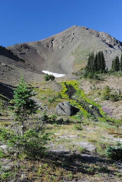
Finally near the Lick Creek headwaters it levelled off a bit in this interesting yellow lichen-encrusted forest.

I set my tent up here. Man, I have to say, that was the second most physically gruelling thing I have done in my life. I pulled my loaded bike up 900 m to 1920 m elevation, but the trail was so unbelievably steep I had to do the last 300 m of the climb twice — once with just my heavy gear, and once again with my bike and remaining gear. So I did 1200 m. I am so glad to have my body back.

While in my tent eating dinner, I heard a large mammal outside.

..

While doing the final packing of my bike next morning, I happened to scan up and this funny-shaped tree stump caught my eye… He didn’t seem to be at all bothered by me. He just watched. Maybe he was following the deer that went by last night. It’s at times like this that I wish I had brought my dedicated wildlife lens, not the mid-telephoto zoom.

I was packing up in the lower meadow in the centre, and the wolf was watching me from another meadow behind the trees on the very left. Also, you can’t really see it because it’s blown out, but there was a forest fire on the other side of the valley there.

Another 150 m of climbing was in order for this morning to get over the pass into the next valley.
..

I had to take my pedals off, which really helped on the narrow trail. I was back to doing two loads…

Amazingly, someone even brought a horse up here.

From whence I came

Finally, over the pass at 2050 m, looking down into the next valley I would descend a little ways into, then meet up with another trail heading right (east) up and out again over into the Pearson Valley.
I have quite a bit of video of the rest of the ride which I’ll add soon, but right now I have some more pressing things to sort out … details to come.

My wolf friend was also using this trail.

It was a shame I had to ride over his tracks but I had to move too.

..

The meadows going up over the pass to Pearson Creek were like paradise … except for the man-eating bugs.

..

..

..

At the time I didn’t appreciate it, because I was being eaten alive, but each of the alpine flowers had a whole community of insects associated with it. This place was like that wonderland you read about in ecology textbooks, with sunshine filtering through colourful meadow flowers, and all the birds and bees associated with them.

..

..

Looking back at another 150 m of climbing to regain the elevation I had lost.

Finally … lunch at the pass, and High Trail going down Pearson Creek.

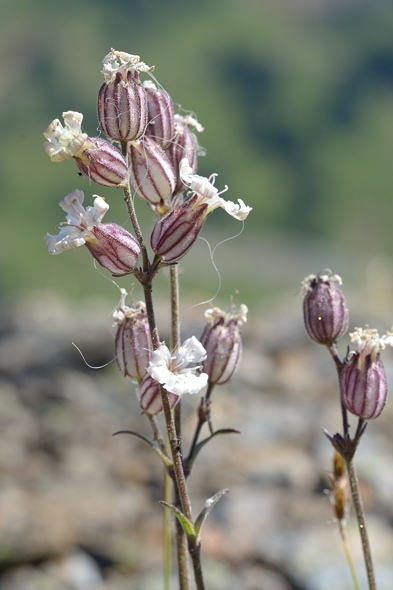
These little flowers have delicate colour patterns on their petals. You just don’t notice all the intricacies going on until you review the macro shots later. That’s a good lesson I think, to stop and smell the flowers in life. There’s lots more going on around you than you may realize.

Stonecrop

..

I had 1000 m of descent ahead of me.

I passed a couple going up (look closely). They were going to go down Lick Creek trail. They were only up for the day, so much less heavily loaded than I was. Everyone up here is super fit; how else do you get up here?

..

One of the more inviting trailheads I’ve come across in my tavels… but I was going down.

Near the bottom of the hill, after all the mud and dust. That sure was a fun descent, but I screwed up my left thumb for a few weeks from all the braking I was doing. I loaded my bike too heavily; it was not performing as I would have liked. I passed another couple going up for a few days and I couldn’t believe how light their kit was. They had backpacks, and plus it helps to have two people, as much of the gear can be shared.

I passed through more hot and dry grassy douglas fir stands.

On the way driving back out, I went by this recent burn.

All clean after my bath in Mowson Pond.


Leave a comment