Chilcotin Bikerafting Route
On Saturday Aug 3 I should be starting my 8 day bikerafting trip through the Chilcotins. Here is a route map:
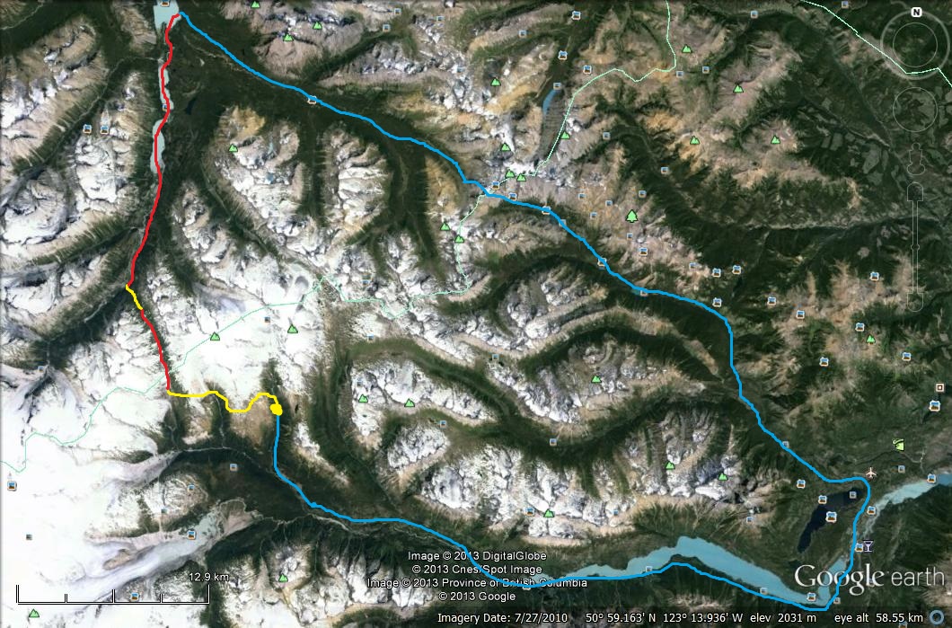
I’ll start at the big yellow dot. The first part will be an alpine hike-a-bike (yellow) westwards over to a river valley heading north. Then I’ll packraft (red) a few kilometers down this. This enters the Lord River valley via a big steep waterfall, so I’ll have to bushwhack (yellow) a km or two down to the valley bottom. Then I’ll packraft 20 km northwards down the Lord River and the smaller lakes it goes through (red), finally emerging at the south end of Taseko Lake. From here there is an established trail (blue) going back to Gold Bridge via Warner Pass.
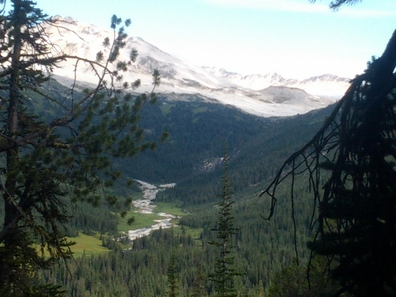
There should be lots of grizzlies and bugs, and epic views. The safe aspect is that I’ll be attempting the hard parts — hike-a-biking and packrafting — first, so if there are problems I will have time to get out. The very first part is up that side valley to the north of the Bridge River. The road goes further up than Google Earth shows, apparently. I found this report from a trip that headed east up from that valley into the alpine. I’ll be starting from the same place, but heading west up into the alpine. This photo was taken looking northwards, right around where the yellow dot is:
I tried to line up Google Earth with that:
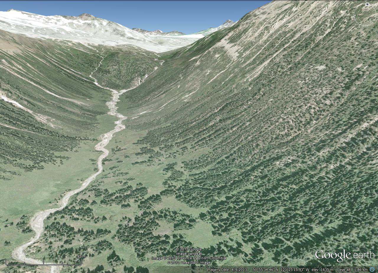
I’ll head up the creek to the end, and then go left up the western fork up to the alpine. Then I’ll turn left and head west over the alpine. Doesn’t look too hard … I’ve said that before!
You can follow my progress on my Spot GPS map page. I’ll update it every night.
Here is my beast:
(no time to take a photo, I’m leaving in a couple hours — I’ll post em up after)
Front fork:
- 2 water bottles
- alcohol bottle
- bear spray
- water filter
Handle bars:
- Tarptent Moment
- two “Mountain Feedbag” stem bags with lunch inside
- maps and other small items in the pocket in front of the tent
Frame:
- “Gas Tank” bag on top tube which has my Nikon V1 and flash
- frame bag has stove set, clothes, tool kit, and a few other things
Rear rack:
- packraft goes on top, with paddles strapped to the sides
- innertube and piece of spare tire are strapped to the rack mounts by the seat stays
- tire pump mounted on top of rear fender by seat stays
- Thermarest mounted under rear rack, wedged in above fender at the very back end of the bike
Pannier
- food, some other clothes, electronics, all other miscellaneous stuff
- Zipshot tripod mounted on rack / bike frame beside pannier
Other side of rack:
- sleeping bag lashed directly to rack
- solar panel mounted in an Ocean Spray bottle right beside this

You probably won’t see this until you get back, but my spot sent no messages while I was on Gun Creek. Either my spot is broken or there is a dead spot in the coverage in the valley. I had assumed that my spot was broken and bought an Inreach, but your position hasn’t updated in a couple of days.
August 8, 2013 at 11:19 pm
Hmm, it seems it missed a few while I was out too. Maybe I needed to leave it out longer, but I did have it out for 10 minutes. A little concerning if you are in trouble and really need a signal to get through.
That little valley is really neat. I got up there and realized I didn’t have enough time to do the circuit in a week, but I could do it in two. Maybe in September… There is a deer trail going up the valley which would make lugging your bike up not impossible. Not easy, but not impossible. Then slog it up some more to the alpine and I’m home free.
August 10, 2013 at 6:09 pm
Mine was set to track for 5 days in the Gun Creek valley and it sent no messages. Spot technical support were beyond belief in how bad they were.
I got myself a Delorme InReach.
August 18, 2013 at 4:21 am