The mosquitos seemed to die back overnight like usual. I think that might be because my metabolism slows down so much while sleeping and therefore I produce less CO2. Mosquitoes are attracted to the CO2. This is why, when I was tree planting years ago, in the big dinner tent with lots of people, the mosquitoes wouldn’t bite you because there was so much CO2 in there they got confused.
But as soon as I got up in the morning and moving around they came back. I hiked the remainder of this particular “Grouse Grind” hill which wasn’t very far. So far the terrain seemed fairly manageable. It soon leveled off a bit and I went by a huge dead cedar snag. It started getting rougher and steeper, and with more bushes and downed logs.
I was heading to the right, the idea being that I’d go up against the flanks of the mountain to my right, and follow this along until I got to the valley pass. This would avoid the wetter and brushy areas down below. I did a few pack runs and made it to the really steep part, where I turned more to the left to follow the steep cliff slopes along their bases. I was working hard but it was do-able. I did this for a few hours and my body was performing surprisingly well.
Every twenty minutes or so a small plane would fly overhead. I had been kept company by them for most of my time up Belize Inlet. I guess this is the main north/south flyway up the coast. And they even came up my little valley too, I presume because the pass is only about 320 meters elevation. I heard them throughout the day flying overhead, probably only a few hundred meters away, and maybe 500 meters higher. They had no idea what was going on beneath in that thick forest.
I could see the lighter green deciduous vegetation of the lower areas down below me, which is part of the reason I was up high because I wanted to avoid it. As I went further along, this lighter green started to come up the hill and pinch me up against the cliffs to my right. I started going up steeply towards the right in order to avoid this but ultimately I came to the base of a cliff which forced me to cross the light green, which was a debris chute that I would have to cross.
But in order to cross this debris chute I first had to hack through the extremely thick regenerated conifers that were at the edge of the chute. These were coming in very thick after the disturbance adjacent to the chute. The ground was very steep and I had to take my backpack off and push it up through the branches ahead of me and rest it in on some branch I could find, then pull myself up behind it. I eventually got all my stuff through and I came upon the little debris chute creek which was just a dribble, and I filtered some water to fill up my bottles since I was going through water like there was no tomorrow. Maybe there wouldn’t be. I was eating Clif bars regularly because of all the energy I was burning. I made a little video of this creek.
As I re-entered the forest I saw that I would not be able to escape an encounter with the infamous devil’s club. This is an extremely spiny shrub which grows via long spindly stems covered in spines and culminates in a whorl of equally spiny leaves. It only grows in wet spots with moving groundwater, which is one reason why I had been avoiding the lower wetter route.
But beyond the unpleasant devil’s cub, the added bonus here was that it was growing out of a pile of downed logs which I had to cross. These created a false ground about six feet above the real ground. I could walk across it, but if I slipped I could be in trouble. But first I had to fling myself and my stuff five feet up onto the first log. Luckily there was a big red berry elder stem which I could grab hold of and swing off of, up onto the log. Oh yeah, and I was wearing my paddling gloves which really helped with hand protection.
I managed to get all of my runs through this section and after this I had a bit of a reprieve for the next couple runs. But then I discovered the downside of following the cliffs so closely – there were very steep debris chutes up here. This next one was not overly shrubby because it was enclosed in the forest canopy. But it was criss-crossed with large and high logs, and the gully itself had large rocks with steep dropoffs; a typical debris chute, similar to what you’d encounter in the treacherous areas of Grouse Mountain.
I managed to get my stuff across this but the terrain was getting worse by the meter. I was getting heat exhaustion and my body was protesting. Further on was a very steep thick fern field growing out of tons more downed logs. That would be even worse to cross. It also happened to be at the base of another cliff but this one emerged from the forest, versus all the previous ones which were within the canopy. It also looked to have a lower section that was climbable, at maybe a 30 degree slope of bare bedrock which went out into the open. I decided to climb up onto this cliff to get a GPS hit and a view of the surroundings. This proved to be interesting as I had to get up to the cliff first. There was a tree or stump or something that seemed to grow all the way from the base and up 15 feet of vertical wall before the sloped rock began. I don’t know exactly what this was, it was all just random organic matter. I pushed / pulled / crawled myself up the tree roots about 15 feet above the vertical base of the cliff. Then the open cliff itself began.
I climbed up another thirty feet or so on all fours along the few mossy cracks that provided some traction, to where I could get a better sky view for the GPS. I noticed saxifrage in the cracks; this is a typical species of these habitats. It was hot and dry in the sun. I set up both GPS’s and went back down a bit to get into the shade. In a few minutes I returned and got my GPS’s. Luckily I got back down safely. This was a dangerous thing to do because if I slipped I could easily be toast, tumbling 30 feet down a steep rocky slope and then another 15 vertically down to that branchy abyss. But there was so much wood and branches and moss and ferns that if I was careful, I could just kind of slide down all that organic matter to where I needed to be. My feet were at times hanging 10 feet above the floor but there was so much to grab hold of that it worked and I made it back.
I pulled out my map and based on my hit, which was in a different coordinate system than what my map used, I had gone about 600 meters and was at 140 m elevation. I decided that I had actually gone as far as I needed to and that the debris chute I just crossed was the valley to the pass, or at least it would get me up to higher elevation to where I could make better sense of my location. So I decided to push on up the hill. I got my stuff together and aimed straight up the mountain to the right. I would go straight up between this cliff and the previous debris chute. I figured that even if I wasn’t at the right spot there was no harm in going up here because it would get me up in elevation and I could then have a better feel for where I needed to be.
I did one complete run of my stuff. It was steep but passable. Then another run which was steeper and more difficult. I did another final run probably up to near 200 meters and that was it. I’m actually surprised that I was able to do that last section. It was incredibly steep with big stumps and logs to get around; more climbing than hiking. Somehow I was ducking under branches with my pack on while going up a 45 degree slope, where if I lost my footing I could tumble 20 feet down until I hit a big bush or tree or something.
I’m using a lot of superlatives here, aren’t I. Well, that’s what this terrain was like. When I got all my stuff up to the final spot where I could squeeze my tent in, and had about five minutes to assess my situation, I realized that I could not go any higher up; it got even steeper. I would have to go back down to the cliff and find a different route. I was also accepting that my body would not be able to take me to my destination. My knee had performed admirably but I had pushed it too far on these last three runs, for nothing it turns out, and I was getting a bad blister on my big right toe.
I weighed the options and it didn’t take too long to come to the conclusion that the trip was over for the summer. The mountain got the better of me. It is interesting to analyze how my mind worked. One minute I was concentrated and determined to keep going, and then after a little bit of weighing the facts, I had to accept the inevitable. Maybe that’s why I’m still around to write about it. I’m glad I have a logical side.
I had a few options but none were really anything I wanted to entertain. I could go back out to the ocean and get a ride around Cape Caution to continue on but that is not the point of this trip; I want it to be self supporting. And I am not confident enough to paddle around Cape Caution; it is too risky in my boat. Plus, it would be mid August by the time I got to Rivers Inlet and by then the weather starts to turn up north. And then I would miss Long Lake and the grizzlies of Smith Inlet, which I really wanted to see.
If I was going to pack it in for the year one option to get back out was to go backtrack down the coast from where I came and back to Telegraph Cove. Another option was to cross over Queen Charlotte Strait straight to Port Hardy, either by paddling across or by catching a lift. But I had absolutely no map of that crossing. I knew there were islands in the middle of the Strait but I did not know where. Any way though, I was currently in the middle of “nowhere” and had several days in front of me to get out.
Anyways, I had decided to turn around so tomorrow was going to be a big day where I would go all the way back out to the water. I did not want to camp in the forest another night. I managed to find enough flat ground to set my tent up to get away from the incessant deer flies ASAP, not to mention mosquitoes, and ate some more Clif bars. I popped my blister and put some antibacterial cream on it. I was quite dismayed, distraught and lonely. I made a video but I was really whiny so you don’t want to see that.
On to the next day. Well today I hiked back out to the water. That’s all there is to say, so on to tomorrow….
Haha, no, a bit more happened than that. I was surprised in the morning that I wasn’t totally seized up. My knee certainly wasn’t feeling great, but it was OK considering what I had put it through yesterday. I got my stuff together and made my way down the three runs back to where I turned up the mountain yesterday. It seemed like I got quite far; I sure was determined. That was a lot of wasted effort though.
I then had to traverse back through the same patch of devil’s club, which luckily I did without incident. Then go back through the thick, steep conifer thicket on the other side of the debris chute. Luckily I had my trail from the previous day to follow, which I generally did.
The going was tough and I was eating Clif bars regularly. I was getting worked up; I just wanted to get out. I was making lots of noise and yelling, partly out of frustration but also to warn the bears of my presence. Every once in a while I’d tap my air horn. So I’m sure any bear within miles knew I was there. I don’t know why I was so concerned since there was hardly any evidence of them here, and none up on this sidehill. There is nothing here for them. They hang out in the river valleys. The creek down at the bottom here may have a few salmon returning in the fall, but other than that there is not much here for a bear.
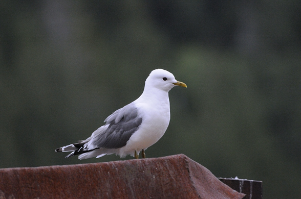
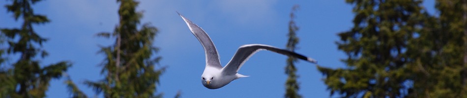
There had been some kind of accipiter (bird of prey) nesting in one of the big trees which I was passing. I could hear it most of the time on my bushwhack over the last few days. It would fly out to the water, then up into the forest again, back and forth and all over, presumably feeding its chick. I thought about how far apart we were in our mobility; it simply takes to the air and within seconds it’s soaring over the inlet, yet I have to fight for over a day with hundreds of pounds of gear just to reach the water. With all the racket I was making, it came down to see me and perched in a branch to watch me for a while, about 50 feet away. That lifted my spirits. I think it was a merlin; it wasn’t very big. I was also eating red huckleberries as I went, which was a great pick-me-upper.
I think my fear of bears out here was more of a fear of the unknown and of being vulnerable, with all my stuff stuck way up this mountain. I saw a couple old scats way down by the creek but other than that, nothing. Seeing the falcon provided me with some company. The cougar incident in Shelter Bay was frightening because I didn’t see it. If I actually saw a bear it would probably alleviate a lot of my fear and again provide some company. I’ve seen them tons in the bush and it’s never bothered me.
Warning: rant mode on. These are the things I was thinking about on this trip, especially during this strenuous hike.
Most of our fears are irrational, and I think they are based on a fear of both the unknown, and of being helpless. This certainly explains our irrational fear of sharks. On average, about two to four people get killed by sharks a year, globally. Now, you could probably think up any other bizarre way of dying you can imagine, and there would probably be more people killed by that than by sharks. Many more people are killed by falling vending machines than in shark attacks. So why, then, are we so afraid of sharks? Well, they look scary for one. But so do many dogs, yet we live with them. We are afraid of wolves and we live with them. We have a history of fearing, hating and exterminating wolves, but then when we turn them into our pets, suddenly they become Man’s Best Friend. We are afraid of being killed by wolves even though I believe that not a single person has ever been killed by a non-rabid wolf (I may be off on that statistic by about 1 or 2 people).
What we are afraid of is what sharks and wolves represent, of us being helpless, floundering in the water while this sleek, fast and emotion-less eating machine takes control of the situation and comes up out of the mysterious deep to take advantage of our vulnerability and kill us. We are in fear of losing control of a situation.
It’s ironic, because if we look at how we humans treat each other, how we treat our food animals, and the environment, then we ourselves epitomize, in every way, every single thing that we unjustly fear about sharks or any other entity people fear and vilify and do their best to destroy. The reason we do not fear ourselves is that we are not unknown to ourselves, and we have control over ourselves (at least we believe we do). Therefore, we don’t fear ourselves. But we can become fearful and hateful towards ourselves when xenophobia creeps in to a society. Then other countries or cultures become the sharks of the world; we become fearful out of a lack of understanding that people the world over want peace and harmony, regardless of their culture or religion. Not to say that many governments are NOT to be feared (our own, most notably), and that they cannot whip up xenophobia to levels which do indeed pose threats to other nations. But ironically, the entities which we should be most fearful of – the banking industry – we freely give our money to. You’ll understand what I mean by this within a year or two….
Getting back to sharks, the only reason they attack people is typically because they mistake us for a seal. They come in, take a bite out of us to taste us, realize that we are not what they thought we were, spit us out, and then they swim away and leave us alone. Surfers look just like seals from below. This is why there are so many shark attack survivors (and every shark attack gets worldwide press coverage). Those that don’t survive shark attacks simply bleed to death and wash up on shore. If sharks really wanted to kill and eat us then there would be no survivors, and no bodies to wash up. Yet, sharks kill two to four people a year. In contrast, we have absolutely decimated shark populations worldwide; we slaughter them by the hundreds of millions. Many species are commercially extinct and it is possible that some could even go biologically extinct. We do this to serve the market for shark fin soup, brought about by a despicable fishing practice which catches sharks, fins them, and then throws them back into the water alive to slowly die a miserable death (see the movie, “Sharkwater”). This is accepted by many because sharks are believed to be blood thirsty killers, and there is no reason for anyone try to change these attitudes when such movies as Jaws and internet stories about shark attacks bring in so much revenue….
Now, given that most shark attacks, especially those from Great Whites, occur because they mistake us for a seal, and considering that my kayak looks like a nice big fat seal floating on the surface, I have to admit that even I was not able to let this fact go without some consideration….. Great Whites attack by coming straight up from the depths and hammering their prey to slash it open, then they return after it has bled to death and eat it. This is a typical feeding strategy off the coast of California (a kayaker was killed there a couple years ago), and especially off South Africa. I’d actually like to go there someday to see it, assuming they don’t go extinct soon. This feeding strategy was often on my mind as I paddled along, because Great Whites do sometimes venture into BC waters in summer. But given the yearly shark attack statistics, I forced myself to put my fears aside.
Back to the commentary of the trip …. the runs seemed to be longer and more numerous than when I was hiking the opposite direction a couple days before. I remembered the landmarks I passed and I tried to count down how many runs I had left. At one point I had to walk down a large rotten log perched about 10 feet above the ground. I had to do this 5 times (for 5 pack runs), and grab hold of a hemlock seedling to swing myself around to get off onto the next log which this one was resting on. I realized how dangerous this was; one false step, or one piece of rotten bark coming loose, and I could be in trouble. I wasn’t too concerned about dying, since even if I broke my leg I could pull myself out the 400 meters remaining and press the help button on my GPS, and then be picked up an hour later. But then I’d lose many thousands of dollars’ worth of gear since I wouldn’t be able to come back to retrieve it before my injury healed.
I was elated when I passed the two big Sitka Spruce twin sisters. These were beautiful large trees growing on the sidehill which I went up to avoid the deciduous terrain lower down. Then I did a few more runs and went by the big cedar snag! I was so motivated. But my body was beginning to shut down. I was incredibly sore and my energy was totally drained. I was mentally tired, but I had to stay focused on this tricky hiking because I did not want to slip. My toe blister was getting much worse and I did not want to look at it out of fear of what I might see.
Shortly after I passed the big cedar snag, I began the descent down the hill where I camped the other night. This was soooooo nice. I could see a long ways through the forest here and it was relatively clear ground on the hill, even if it was steep. I could smell the ocean on the warm breeze coming up off the water and over the hill. I could see it glistening in the sun through the trees, only a couple hundred meters away. There was no way I was going to camp in the forest tonight, regardless of how my body felt. This was not only because psychologically I needed to get out, but also because my body would likely seize up by tomorrow and make any hiking very painful. I needed to take advantage of my activity now and make the final push to get out, no matter how much my body did not want to go on. I needed to get to that barge tonight.
I could not rest for long between my runs because the incessant deer flies and mosquitoes assaulted me after about 10 seconds of not moving. I could not protect myself from the deer flies because they were biting through my clothes and they are painful. I was so stressed by this physical ordeal and the sweat and the flies that I took not one photograph today. I did not want to spend any time messing around with cameras. I just wanted to get out. This is a shame, because that was the most interesting part of the whole trip psychologically and physically. It would have been a great video shot to have me warily poking my way along that huge downed log, meters above the steep ground. But I was not concerned about such things. I have to give Survivorman credit for managing to keep the film rolling when he is under such stress.
This spot had a lot of cut up cedar piles. These are left from the cedar shake salvagers, who go into areas that were previously logged a long time ago when it was not economical to bring out all the big pieces of wood. But cedar is very rot resistant, so even a hundred years after being cut, it can still be viable, and a worthwhile source for supplying the shake roofing market. So a lot of the old cedar stumps and logs were cut up with big chunks left in piles. I’d estimate this whole area was probably logged about 60 to 80 years ago. I hadn’t gone through any old growth on my bushwhack. I had almost gotten to it at the end, but the reason that forest has remained old growth is because it was too difficult to access and cut down back then. That’s also why I didn’t make it any further….
And all along my bushwhack there were pink and orange ribbons from previous forestry surveys, probably timber cruisers looking to see what the wood was like here. It was mostly hemlock with a bit of spruce and cedar, not too valuable. So I wasn’t in totally uncharted territory out here.
At the bottom of this steep hill it got brushier and I had to fight this and within a couple more runs I was back up on the bench by the creek. I could taste the end. I finally made it to the final run across the creek to the grassy beach. I decided to set up my video camera and get one shot of me hiking my gear. I’ll put it up later.
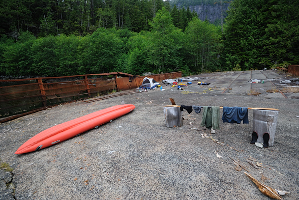
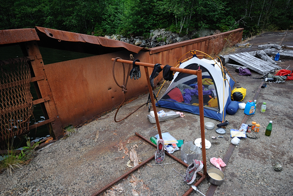
When I finally got my stuff to the grassy beach I had to pack it up quickly and set up my boat because there wasn’t much day left. I made two runs over to dump my stuff on the barge and filled up my water containers at the creek. I set up my tent, made dinner, and called it a day.
That had probably been the most physically difficult thing I have ever done in my life. I have done big mountain bike races before, riding 70 km through the mountains from Squamish to Whistler. But I was in better shape back then. And those races only went for a few hours. This went all day and I pushed my body to the limit. Whew! It was done. I checked my toe and the previous blister had worn away and the layer of skin beneath it had made a new blister, even larger. But there was little blood, thankfully. Even as I write this today, months later, I still have numbness on that part of my toe from the nerve damage. Now my concern was how my body was going to feel tomorrow and then, how I was going to get out. I would take a day off on the barge tomorrow and then plan to paddle back out the day after, camping at the empty logging camp I passed on the way in. I would probably try to ask for assistance in crossing over to Port Hardy if I could find it, since I decided that this was the best course of action. But I had no idea what that crossing entailed specifically, other than what the previous kayaker had said (the last person I had spoken to) – that it was windy and rough and not recommended for an inflatable kayak.
When I woke up the next morning my entire body ached. It was painful even to lift my arm. But after I got up and moved around a bit I loosened up. I was pleasantly surprised to see that my right knee tendonitis wasn’t exceptionally bad, which is amazing considering what I just put it through. It was of course very sore but I could still walk OK. I had soreness in muscles in my legs I hadn’t felt before. Everywhere hurt. You know, “the burn”.
Today I ate a lot of food; I had dinner for breakfast, dinner for lunch, and dinner for dinner, and I think I also had an extra dinner in there too. Lots of nice spicy food. Of course I ate lots of raw brown sugar too.
I watched seals playing, or fighting or mating or something, just off the barge. This is a productive inlet here with shallow water at its head. I was surprised that even here, so far from the ocean, the tidal range was still about four feet.
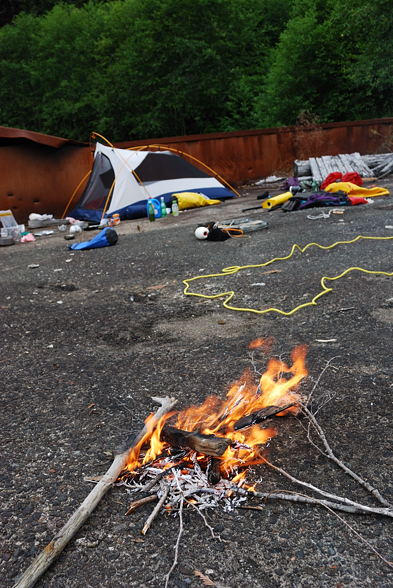
I made a fire which lifted my spirits. There was a lot of wood on the barge and it seems that previous people had done this too. It’s a great place to get off your boat if you come up the arm. It was disheartening to see a gallon jug of motor oil left there by someone. I don’t know how to get that out. I certainly didn’t have room.
I went to bed for the night and as it was getting dark I thought I could see flashes. I wondered if I was going crazy but yes, there was some lightning off in the distance. I didn’t hear any thunder so it was a ways away. It sprinkled a bit too.