Beginning the Trip for Real Now
I have been sidelined away from my trip for the last month, in large part due to the urgency of preparing for the upcoming financial collapse which could happen anytime, most likely within the next 2-5 years. I suggest that you try to understand what is going on as well since the implications of these events will be catastrophic for the whole world. Blogs I recommend are FOFOA, Chris Martenson’s Crash Course, Jim Sinclairs’ Mineset, GoldSubject, Harvey Organ, King World News, and the Youtube videos “Money as Debt” parts I and II.
The weather has also now finally improved. I will be leaving very soon, like this Sunday or Monday. I will try to update the blog every couple weeks. I’ll also have to cut the trip short as well since I am a month and a half late in getting started. I am now only aiming for Prince Rupert, and instead of going down the Taku (which would be in October), I’ll go down the Stikine River from Telegraph Creek to Wrangell, Alaska.
You can follow my progress online through this map. I will try to update my GPS Spot tramsmitter daily. If I am bushwhacking through forest for a few days then I won’t be able to.
http://share.findmespot.com/shared/faces/viewspots.jsp?glId=0bMbRzfyQ2OPP2qrb5cJE6uKG4R8SraWt
Day 2 – Earth Day – The Adventure Continues
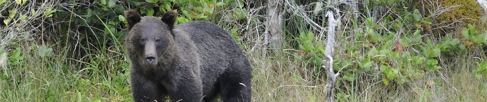
I seem to have a knack for going kayaking on very windy days. I took the Canada Line skytrain to the 99 B line bus, and this along Broadway Ave. to where I pulled out on Day 1. It was a beautiful day, but very windy from the west. I set up on the beach and tried to put in, but my kayak got swamped by the waves. It would have been possible if necessary but I would have been sitting in a few inches of water, without a bailer. Although my kayak handles well in big waves, it doesn’t launch well in them. This makes me feel even better about my planned detour around Cape Caution north of Vancouver Island – a 30 km stretch battered by the open ocean. I’ll avoid the big seas by rerouting through the mountains inland, prime grizzly country…… just what I’m looking for.
So instead I packed my stuff a little farther down the beach to the lee side of the yacht club, which was pretty calm. Along the way I passed a beached sailboat in the exact spot which I pulled out from last time. The day after, a major record-breaking windstorm had hammered the coast all day, cancelling ferries and beaching many boats.


The beached sailboat in the same location I pulled out last time

The sandy trail around the back of the yacht club


Unfortunately, when my kayak got swamped in the surf, my underwater camcorder housing hit the sand and it got in the controls, so most of the footage taken that day was not worthy since the video was stuck zoomed all the way in to my shirt. And I didn’t have the mike on properly so I got no audio. But I have a little bit of video, which I will upload later when I set it up with WordPress.
I quickly blew eastwards towards downtown. The waves were breaking. When I neared Kits Beach I could see more beached sailboats, but the wind died down a bit. I was having fun just bobbing around in the middle of the bay and I thought I made some videos but they unfortunately didn’t turn out. I’ll have to make a couple modifications to the system to make it easier, but it’s definitely beginning to produce some quality video ….. when I haven’t zoomed all the way in from sand in the controls ….. and there isn’t water on the viewing lens ….. and I have switched the mike on … and the mike is on the right channel …. It all sounds very obvious but when you are out there in the elements with salt water spraying everywhere and it’s so bright in the sun that you can barely see what the camcorder’s viewscreen is doing, it’s easy to miss any one of the five things you need to do right in order to get the video to work. But the more I do it, the more I’ll figure it out.


I crossed over towards Beach Avenue and had fun looking at all the cars and people. It seems kind of weird to see human civilization from this vantage point, almost out of place, with everyone crammed like sardines into the land, fighting over half million dollar tiny condos, right next to all this openness. Maybe the next step will be floating condos. Wait … wasn’t that a bad Kevin Costner movie? Waterworld. With the money everyone’s making off real estate development here, I wouldn’t be surprised by any scheme they come up with.
Grouse Mountain had its wind turbine going full speed, which doesn’t seem too fast with a full turn every 5 seconds or so. But then consider that the circle is the better part of 100 meters across. Those tips are moving really fast. That’s 150 meters in a couple seconds, which is near 200 kilometers an hour. This turbine is on top of one of the southernmost peaks of the Coast Range which I plan to encircle. From here on, I’ll generally head northwards with the mountains on my right. To the south, the range breaks up into more scattered volcanoes through the Seattle area. It kind of becomes the range known as “The Cascades”, but those mountains are further inland than the Coast Range is, which meets the ocean with a myriad of inlets of islands.

I used to hike up that mountain on the Grouse Grind, a trail that goes from the bottom left up to the building. For over a year I have been out of commission with nerve damage in my leg which led to atrophy of my quads, and then severe tendonitis in my knee after foolishly pushing it too hard when resuming activity after the nerve problem was fixed. I hope to be back in action in a few months, and I'll need it if I want to descend the Taku.


I turned left to head back west to round Stanley Park. Then, of course, the wind picked up again. And I’m not just imagining it simply because I turned into the wind, since the trees on shore were all confirming to me that, yes, it actually was blowing really hard with big waves. Every time I hit one I’d get sprayed with water, and I would have gotten quite cold if I wasn’t paddling so hard. Half the energy I expended all day was just to go that 1 km around Stanley Park. And I didn’t bring any warm weather clothing. But once I rounded the point in Stanley Park I could turn northwards and then had a cross wind to deal with, which made it faster going, but a few times I had to turn to avoid getting slammed sideways by large breaking waves.


I began crossing the entrance to Burrard Inlet, near the Lions Gate Bridge. The waves became choppy and unpredictable since the tidal flow into and out of the inlet was mixing with the wind-generated waves. There was an eerie lack of boat traffic here. It is one of the busiest ports on the coast of the continent, and I didn’t go by a boat of any kind the whole time around Stanley Park. I was expecting at least some sailboats to be out taking advantage of the wind.
I reached Ambleside Park in West Vancouver but the large waves would have made pulling out on the beach an unpleasant experience. Luckily there is a public wharf and dock nearby so I tied up to that, which was almost high and dry with such a low tide. I was getting cold but managed to pack up and then walk a few hundred feet to catch the 252 bus to Park Royal, then the 239 to Capilano Road, then the 246 Highland to get back home.

Mount Baker in Washington State, a dormant volcano, as seen from near the Lions Gate Bridge

The view from the trough of a large wave


My wrist didn’t give me any trouble, even though it has been bothering me lately otherwise. It’s weird how small movements with the computer mouse can give you painful tendonitis, but strenuous paddling doesn’t. I use the same tendons on the upstroke. I was surprised by how strong I was. That is my biggest fear for this trip – being stopped in my tracks by tendonitis. Not bears, hypothermia, loneliness, starvation …. but tendonitis. Luckily, I will know within the first week if it’s going to be a problem and so far it doesn’t seem to be. I’ll just have to limit my computer time and thankfully I’ll have no choice in the matter given the battery limitations. Although, I managed to figure out how to run my computer off 14 AA’s for about half an hour, and these can be charged with my solar panel in a day. I don’t think I will have a lack of battery power on this trip.
Day 1 – Richmond, BC to Vancouver, BC
I started my trip on April Fools Day. It was one of those days where something seemed to go wrong at every turn. Thankfully I survived, as did (almost) all of my gear, and I can say that the day left me “tougher”, not “tireder”.
In keeping with my theme of low-carbon kayaking, I took myself and all my stuff on the Canada Line Skytrain line south from downtown Vancouver to Richmond, BC, near the international airport. This is right on the floodplain of the Fraser River, the largest river in BC, and the most southerly of the 10 BC rivers that flow through the Coast Mountains. It is in this exact spot that I plan to finish my trip next year when I complete the circle around the Coast Mountains.

Low carbon kayaking
I had looked on Google Earth and saw that there was an easy 1 km walk between the skytrain station and an access point to the river. Unfortunately, I took the wrong turn while walking and ended up having to walk 3 km the other way down the river, only a short distance away from it but unable to reach it because of a trench and fence (and an important wildlife area, so I can’t be too ticked off).
When I finally reached the river at MacDonald Park, I noticed that I had left my video camera running for the whole walk and had almost run the battery dry with a half hour of footage of the roadside. It’s gonna be one of those days … the more frustrated you get, the less attention you pay to what’s happening and then even more things go wrong. Luckily, I had brought another battery with me, and I also had another video camera safely inside its underwater housing.

At the Fraser River ... finally

At the dock, since the bench above was not near an easy entry point to the river
I walked down the dock ramp and organized myself in some nice semi-sunshine. It was starting to come together. I finally entered the mighty Fraser and was immediately swept downstream in a swift current on a low tide. The river really flows here. You don’t really realize it while looking at it from the road. Luckily I wasn’t fighting a rising tide, which would counteract the river flow. For a few kilometers I leisurely paddled downstream, going many times faster than my effort would suggest. I like this sluggish river kayaking.

A happy couple
I was trying to get video footage of myself paddling and speaking at the same time. It all works well in the controlled setting of a house, but it will take some time to get it all sorted out in the kayak. I have so many little things to keep track of, and there’s water flying everywhere from the paddle. What I need is to have each of my several cameras in its own waterproof bag with a little towel in each, so that when I take it out my hands are dry and there is nothing else in the bag that gets in the way. Just more waterproof bags to buy…..

Chip barge and processing conveyors

Developing squall over Richmond to the south

Right after the squall

Taking refuge against the log boom
The speed of the river slowed as I approached the ocean. Along each side were log booms and mud banks, and the odd barge of wood chips. Cottonwoods dotted the riverside forest, one patch full of noisy starlings. All along I could hear the call of the redwing blackbird, a nice sign of spring. Lots of mergansers and coots too, along with the usual west coast familiarities of the great blue heron and bald eagle.
I noticed a squall to the south, and based on the wind direction, prepared to get hit with it. It didn’t take long, and it came like a wall. I took refuge against a log boom and put on my raincoat, and everything was fine! That’s what rain gear is for, I guess. After 10 minutes it eased up.
I continued on past the last marker denoting the beginnings of Wreck Beach beside the University of BC. It was interesting to be seeing UBC from the reverse direction, after so long behind a desk there looking out. As I rounded Point Grey I got hit with a headwind. It didn’t abate and my wrists were getting a bit sore – I am trying to keep some tendonitis from flaring up. I decided to get out at Alma Street. As I passed Jericho Beach I ended up on the expansive sand flats in about a foot of water. These extend a long way out from shore. Luckily, a foot of water is six inches more than I need, so I kept on. Years before I had come here to dig up mud shrimp for the aquarium. I wasn’t in the mood to go searching thus time, so maybe another day. These are interesting guys that live in little tunnels and move sand around like earthmovers.

Vancouver's North Shore viewed from Point Grey
On the wind coming from the east from downtown Vancouver I could smell the cottonwoods leafing out, probably from Kits Beach. While I was contemplating the nice aromas on the breeze, I also noticed dark clouds forming to the south over Vancouver near UBC, and the increasing wind speed. I was aiming to get to the Vancouver Sailing Club’s beach, since this would be my take-out point. About a kilometer from the destination, I got hit with another squall, but this one was major. Apparently it gusted to 40 knots and turned over some small sailboats at the dock. The rain was coming down in horizontal sheets and I was getting hammered from the side by strong wind. Luckily, with this direction of wind, the short distance from shore prevented any really large waves from forming.
I am happy to say that my kayak handles rough seas very well. It is very difficult, if near impossible, to capsize when fully loaded, except maybe in crashing surf. That is the advantage of an inflatable with pontoons on either side! The drawback, of course, becomes clear if it springs a leak. So I will have to take extra caution to avoid that….. I will also bring plenty of repair equipment. The dangers for getting a leak are the razor sharp barnacles and mussels on the shore. I will also try to avoid bothering sea lions, since I would not want one testing out my boat. I plan to rarely be far from shore, and when I am forced to cross open water I have a drysuit and VHF radio in case of an emergency.
The advantage of this kayak is that it packs up into a 30 pound backpack, with which you can hike through the bush. This opens up many opportunities for me to explore some unique places along my trip up the Coast (in other words, LAKES and RIVERS!), which I would otherwise be unable to do, being restricted to the ocean. My kayak isn’t quite as fast as a regular sea kayak, but it’s no slouch. It’s all about compromises, and this trip isn’t about speed.
I landed on shore and began breaking up the boat, walking around in bare feet on the sandy beach in a 7 degree C squall. Yes, I was a little cold. Fortunately, when you are doing something strenuous you also make heat so you stay warm. The problem is when you stop doing what you are doing — then you get cold. It was an interesting sensation to put my feet in the ocean on April 1, and the water felt warm.
I managed to walk up to Broadway with my stuff and catch the 99 B line bus back to the skytrain, along with the other UBC students heading home after a day in class. Day’s numbers: 5 km of walking, 17 km of paddling, many km of public transit. Luckily my tendonitis didn’t act up. This was a difficult day, and my performance is promising.

Downtown under the bad weather

Yikes

The Lions Gate Bridge getting hammered

A small portion of the pod of seals who were wondering what I was all about

"What are you doing?"

UBC and Wreck Beach behind the last of the log booms

A tug boat doing its work on the river, against a backdrop of spring storms

Fortunately, I was going downstream, not up. The tugs have the power to pull logs either way.

A bald eagle taking a break on the mud flat. I think I'll see a few more of these guys...
