August 5 — Across Queen Charlotte Strait to Port Hardy
I got up as soon as it was light because today was going to be a long day. I wasn’t sure if I’d make it all the way to Port Hardy or not. That all depended on the weather. I would get to the islands in the middle of the Strait and reassess then.
The weather was calm and foggy and I packed up uneventfully despite the steep wet rocks leading down from my tent site, put on my drysuit and loaded up. Loading the kayak was a little tricky because of the slippery bedrock at low tide but the few patches of barnacles amongst the rockweed gave me enough grip. I set out and said goodbye to the starfish watching me load my boat from below.

I would have to use both my compass and my GPS. I did not know how long the batteries on my GPS would last so I did not want it on all the time. I would turn it on every once and a while to confirm my direction with what my compass was telling me, and I had to spend a few minutes practicing how to use it again. I was heading due south which should take me to the coordinate given to me yesterday: 50-54. That sounds kind of like the name of a band from Vancouver called 54-40. They are named after a political campaign from another age when Americans in Oregon wanted to push the northern boundary of the US up to the line 54 40. They didn’t succeed and it stayed at 49 degrees.
I have had various songs by 54-40 in my head for most of my trip and today I had Baby Ran which seemed appropriate.
I started videotaping my paddle soon after and within a few minutes I reached the end of the main island and where I would head out into the open water. I passed by another little island, then saw another little bird rock off in the distance, the final one. I went by and observed the birds and the waves breaking, and after this I entered the blind fog. I noticed that the batteries on my audio recorder had died so I turned off the video.

The danger here is that with the limited visibility a big ship could run me down without realizing it because I couldn’t see it coming and it couldn’t see me. I could hear a lot though because the wind was calm and the sound traveled far, but because of this it was hard to get an idea of how far away things were. Determining the direction of sounds wasn’t a problem, however; all along I had a foghorn off to my left which was probably coming from somewhere around Shelter Bay. This followed me for miles.
Once out in the open I could hear a large vessel approaching from the north-west. It was something fairly slow, but large. I kept my eye open and tried to judge its direction in relation to mine. After about twenty minutes it became apparent that it had passed behind me and I relaxed a bit. This northern channel is not the main waterway up the Strait thankfully.
There were regular visits from seabirds flying by and swimming around. I continued on for what have must been a good hour and a half, heading due south into the middle of nowhere. I had nothing to give me bearings except my navigation aids. Plus the foghorn, and the direction of swell. I noticed that if I didn’t keep an eye on the compass I would naturally turn into the swell which was coming from the north-west. As for my destination, all I had was the GPS coordinate to go on. The water was calm with rolling swell, and no winds. I wondered when I’d first see land.

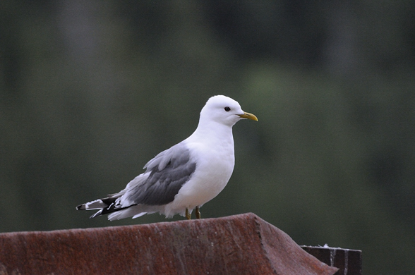
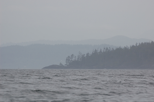
My first hint wasn’t visual, but olfactory. I could smell bird guano and that told me I was coming up to something. Then I could make out small islands far off to the right.

There’s an island there if you look hard.
As I passed these I began to see more faint outlines of larger islands and eventually I came to the main one, Kent Island. The shoreline was confusing and I had no idea of the shape of these islands. I just kept heading in my general direction as long as the island would let me. I was getting pushed more to the southeast by the coastline.

Luckily the currents were going my direction, and I went past extensive kelp beds.

The pleasure boat traffic was fairly light and I eventually passed through a channel between this island and another large one to the east. I could hear oystercatchers here and I had wanted to get audio of them for a long time since they make the greatest noises. But now there was always the sound of some boat or plane in the background so there was no point. I stopped to take pictures of pigeon guillemots flying around and entering their nests on a little island. The nests are in the roots of the trees and salal just above the high tide line. The vegetation here is very luxuriant, with what seems like an impenetrable green understory of salal. Spruce manage to poke through it. This is hypermaritime forest, that’s for sure.


The pigeon guillemot island
There was a fish farm across this channel, and boat traffic picked up considerably here. The currents were all over the place. One minute I’d be going with them, then I’d round a point and suddenly I’d be fighting them.


I decided to keep moving and head for Port Hardy today because it was barely lunch time and the weather was still calm. When I reached the end of this island and saw a large crossing before me I took lunch by tying off to some kelp right at the edge of all the action. If I was looking for company a few days ago, well I found it. There were tons of boats here (well, relatively speaking). The fog was beginning to lift and a BC Ferry actually went through the channel up ahead of me, on its way up to Prince Rupert! This was a lucky sight because it doesn’t run often. This is not the Queen of the North, but its replacement which I do not know the name of. The Queen of the North sank a few years ago in the treacherous waters off Kitimat, beside Princes Royal Island which I plan to visit and cross (via a bushwhack…) when I resume my trip. The ferry hit some rocks and sank to the bottom, taking two lives with it. This is the exact same location where the Alberta oil companies (Enbridge) want to run oil super tankers (not just regular tankers) to take synthetic crude from a planned pipeline linking Alberta. And they are assuring us that this will be safe…. yet this same company has had numerous recent large pipeline spills across North America. Last summer they spilled 800,000 gallons in the Kalamazoo river in the US, at the same time that they were assuring us the pipeline would be safe.


I sat there eating my dates and peanut butter. A largish pleasure boat of some sort went by and left a stink of diesel which was shortly followed by an oil slick that lasted a few minutes and stunk to high heaven, and left gunk on my kayak. I don’t know how much they were leaking but it had to be noticeable on their fuel gauge.
After the oil slick washed away on the current to somewhere else I put my hand back in the water to wash off my knife and fingers, and made my own little oil slick of peanut butter. I think that’s a little more benign than diesel though. I started out again to cross the channel and spotted a large California sea lion off the bow. Then I turned around and noticed a sailboat coming up behind me, the Snow Goose! This is the boat that gave me the coordinate yesterday. They were watching out for me and were surprised at my fast time. We talked for a while and took photos of each other because it’s hard to take a picture of yourself in your boat when you are in it! Something I have noticed, paddling alone….. I could actually set up my tripod from shore and make this the last thing I pack up when I leave, and then come back for it after the timer or video has taken images of me leaving, but I normally bury my tripod in my pack to avoid getting salt spray on it. I tried packing it exposed once, way back in Blind Bay by Nelson Island, and I got salt all over the head which is not ideal treatment for metal equipment. I need a somewhat splash-proof bag to put it in, and then strap this outside my pack in my boat, which will make it much easier to head out after retrieving my tripod after the photo.
Anyways, we will send the photos to each other later on. They wrote down my email address but understandably I didn’t get theirs. We arranged to meet in town for dinner later on. They gave me directions to the best location for getting through the next set of islands and from there on to Port Hardy.

The visibility had really opened up and I could see over to Vancouver Island by now. I started crossing the channel but the going was slow. It was a deceptive five kilometers; it did not look so far. I went by a buoy and confirmed that I was fighting the current. Finally I got to the other side and took a break up against the shore of the islands. I had a Clif Bar. Actually, I think I had two (my last ones) since I knew I would have all the food I wanted later on. There were now more and more boats all over the place, little fishing speedboats.
I went through the channel between some islands and had fun riding the currents which were going my way. I went right by the steep rocky shoreline, on the inside of the kelp. That is a handy waterway that kayakers can take advantage of. Immediately off the shoreline there is no kelp because it dries up at low tide. And when you get too far away from the shoreline it is too deep for the kelp to get started (it needs light to grow). So kelp grows in a strip just off the shoreline. This creates a little waterway between the kelp and the shore that you can ride (during high tide), if the currents are going your way.
I took some video of this but of course no audio. Then suddenly I crossed a line and I was fighting the current again. I figured this would be the last opportunity to get some pictures of me in my boat so I set my GoPro camera to the timer so that it would take a photo of me every three seconds, then I got out my wildlife camera so I’d have pictures of me taking pictures.

Various barnacle and mussel species
I then started the next crossing, the final one, over to the big island. It was mid afternoon and the wind was starting to pick up. I had about six kilometers to go to round the final point into the big bay protecting Port Hardy. The wind was coming down the Strait, kind of from behind me, around four o’clock. This helped and I made good progress.

The final point before Port Hardy’s bay
It seemed to take a long time but I made it to the other side where there were tons of sport fishing boats milling around. I guess the sockeye were running. It was weird looking at people in their boats, they looked like they just came from watching TV in their living rooms and jumped in their boats to come out here and catch some fish. None paid any attention to me. A big cruise ship went by on the other side of the islands I just paddled through and I wanted to round the point before its wake caught me. Luckily I crossed the Strait before it came through.


Finally I made it around and then I saw that Port Hardy was still five kilometers down this bay. I saw some eagles eating fish on the rocks, probably discarded from fishing boats, and stopped to take photos, as well as of other shorebirds running around the barnacles above the waves. Interestingly, on one of the final paddle strokes with my bird lens out on my lap, I caught some kelp and it flicked water on my lens, on the focus ring. I swore and mopped it up but some probably got in behind. Now it happens …. in the final hour of my trip, I finally get some salt water on my cameras. I was planning on bringing it in for a cleaning anyways because earlier in the trip the focus ring seemed scratchy, probably from some fine sand getting underneath.


After this a fishing boat of some sort pulled up and pulled up its trap. The guy nodded at me. There were some nice protected cobble beaches here that would have made good camping spots but I couldn’t pass up the opportunity for a nice meal tonight.
I had a nice tailwind but those last five kilometers seemed to go on forever. On approaching the town I had to head east to avoid some shallow water and then I got to the main federal dock in the center of town.

I was experiencing culture shock again, I didn’t know what to do. There was so much going on. There were all these kids casting off the dock and I didn’t want one catching me. I went under to the other side and talked to an official looking guy about where to spend the night camping and he said that I should go farther down to the other side of town to the main marina and they would be able to tell me.

That’s what I did, another kilometer down the harbour. This marina was packed with boats, I’d never find the Snow Goose here. I tied up and walked up the ramp to the big tourism complex and called my mom from the pay phone. She seemed disappointed when I told her I was coming back; I think she was hoping she would be rid of me for longer. I went into the tackle shop and asked the guy at the counter about camping and he was enthusiastic about the campsite up the river. I’d just have to go up the estuary and the campsite was right on the riverbank up from there. I could just land my boat on the shore and walk up. The river had at least 10 feet of water so it would be no problem. That was good.
On my way out I saw the cleaning station for all the halibut, salmon and rockfish being caught all over the Strait. Wow, I couldn’t help but notice how wasteful that is. The amount of meat left behind on one of those halibut skeletons would stuff me for a whole day on my trip. I would have gone to great lengths to have that anywhere on my trip. There were big yelloweye rockfish skeletons in there too, they were all being thrown into big blue plastic totes. I don’t know what they do with that, hopefully it doesn’t go to the dump. That would make some good pet food or fertilizer. It was a bit depressing to see all these interesting fish thrown in there, especially since those rockfish species are in trouble, and those big yelloweye rockfish could easily be well over a hundred years old.
I returned to my kayak and made my way back out of the myriad lanes of the marina and headed up the estuary.

The shoreline became light industrial beside the highway. It was an unglorious treatment of a productive estuary but oh well, I guess no one paid much attention to those things back when the town was developing.
I got as far as I could and then it got too shallow. I could see the campsite a few hundred meters away but I couldn’t get there on this low tide. I was pissed off. Yeah sure, ten feet deep! What a waste of effort. I weighed my options and decided to hike my stuff across the gravel bars to where the river was deep enough to paddle up. So 15 minutes later I finally got across and paddled up to the campsite. I found a place I could land and hiked up to see the campsite. I couldn’t believe how small and cramped the spots were. And it was more of a trailer park than a campsite. Maybe I was spoiled from all the amazing places I had been camping in over the last few months, but there was no way I was paying money to camp there!

The campsite is that little bit of white you can see in the trees on the right. First I had to get there!
I got back into my kayak and humped my stuff back over to the ocean and went back into town. I was getting tired and frustrated. I just wanted somewhere to sleep. As I was leaving the estuary there were many salmon jumping around my boat, presumably sockeye which were waiting for the river levels to rise. That’s what all the boats were after I guess.
I fought my way back up to the main federal dock, against the wind, and passed a Dragon Boat full of women practicing their rowing. I landed on the dock and asked some people about where I could stay and one guy who was staying on his boat said he was just sleeping on his sailboat tied up right there. The harbour master didn’t seem to be collecting any money. He figured I could pitch my tent right on the dock. It seemed a little rough and exposed, and there were people everywhere as well as lights. But I pulled all my stuff onto the dock and went into town to get some food.
Port Hardy is an interestibg place. There are a lot of vacant buildings around. It seems like its boom times from forestry, mining and fishing have subsided, and Port McNeil has taken on a larger part of that role as well. But it retains a lot of community spirit as there are flags everywhere and there seems to be an effort to maintain the town center. Maybe I am just judging with big-city eyes, where every available square foot is allocated to some real estate scheme. But the town does seem to provide a picture of what to expect when economies inevitably stop growing — visibly boarded up, vacant businesses, something never seen in Vancouver for any significant length of time.
I walked around looking for a grocery store but didn’t find anything so I went into a convenience store and ended up buying a box of crackers and a big chocolate bar. Really healthy. Oh well, I deserved this after the last few weeks.
I returned to the dock and then had a chat with a native guy and his son who had emerged from their aluminum boat. I asked about camping on the dock and he didn’t mind. They had just come down from Prince Rupert and were here for the salmon run. I asked him about the weather up north in August and he said that it definitely can get stormy in August in the northern half and that it was probably not a good idea to risk it this late in the season. He talked about how rough Cape Caution can be too. So that made me feel better about my decision to call it quits. I thought I could instead return to Telegraph Cove and go on an organized grizzly tour up Knight Inlet, or paddle back to Robson Bight for a week. It was only a few hours away from my mom’s house by bus.
The first guy in the sailboat mentioned that the building right by the dock was abandoned and that there was an old parking lot behind it where I could camp; that seemed ideal. I waited until it got darker to set up but then up pulled the same fishing boat that had the guy who nodded at me earlier. It was a live rockfish boat. They catch the rockfish and keep them alive so they can fetch a higher price in the Vancouver seafood market. It was interesting watching them unload because every single fish was counted, by species. And there are a LOT of rockfish species up here. People think rock cod are rock cod but no, there are lots of different types. People don’t realize the diversity of marine life we have off our coast, and these are beautiful bright colourful fish, as bright as any tropical fish. It’s just that they live in cold pea soup so they don’t show as well as the tropical ones.
The fish were being counted by a contractor hired by the government to monitor these things. It’s amazing how many fish they had in those live wells. They just kept pulling them out. And rockfish have venomous dorsal spines (they are in the same family as the tropical lionfishes). These workers were picking them up with rubber gloves. I asked if they got stung and they said they have gotten used to it.
It was a little sad seeing all these rockfish coming out. I wondered how sustainable this fishery really is and if the monitoring is really being used to ensure that it is sustainable. Based on the history of politics in fisheries management in this country, probably not.
After this I went back to my tent and cooked up some food and went to sleep. It had been a big day with 40 km of paddling. I would see about getting the bus back home tomorrow.

August 4 — Back out Nakwakto Narrows into the Unknown
I slept without the rain tarp over my tent last night as usual since the moisture from confining my breath inside the tent is generally worse than the dew I get from having my tent open. The fog formed early last night and after that there should be no further dew on the tent. It was very thick fog this morning but the layer was not very deep as I could see the mountains and sun poking through.
I filled my water bottles from the hose, dumping the water I got from the waterfall yesterday since I figured this water would be safer to drink, coming from a well I presumed. The waterfall was surface water which is more risky to drink without filtering. I also gave the flowers a water. I went on a salal berry picking excursion and had some oatmeal which was good. I never seem to get sick of that stuff. I packed up and gave my tent a shake. Unfortunately it had my little flashlight in the sleeve, and this fell out and landed in a crack between floating logs and down into the abyss. I really need to pay more attention to what I’m doing.


The bay behind the floating camp

The morning paddle was beautiful, through the calm and fog, with the sun brightening everything up. Everything was still and silent, except for the loons and grebes flying through the fog like ghosts.


I rounded points and stared into the clear water to see leather stars and ochre stars perched on the rocks. There was decent current around the points.
My plan was to flag down the first boat I saw and ask for help. I was hoping to catch a lift across to Port Hardy, but even just some description of the crossing would be enough help. I pondered going up to the end of Seymour Inlet which has a big river, as there would certainly be grizzlies there. But I only had a week’s worth of food left, and I’d probably be at least a week and a half to go there and back, while spending some time to observe the bears. It is a good 70 km to the end of the inlet from the Narrows.
I was very wary of running out of food. I was able to catch fish and eat berries but for some reason I had a great fear of running out of food. I think my eating was as much psychological as physical, and I was intimidated by the thought of not being able to eat whenever I wanted and instead having to go out and get it. Another irrational fear. Bryan and Maggie managed to do it. In retrospect, living off the land would be an interesting aspect to my journey and I think I will try to rely on this more next year. There is certainly no lack of food here if you know where to look and how to get it. If I didn’t have to spend all day paddling I could live very well here, completely off the land (and sea). Between the seaweeds, berries, fish, and shellfish, you could gorge yourself.
I entered the main channel of Belize Inlet and the fog was still very thick. At times when going from point to point across bays, I couldn’t see the point I was heading for. Eventually the fog began to lift and I saw a pleasure boat ahead across the channel. This was a welcome sign after being alone for so long. I crossed over to the south side of the inlet and went back around Mignon Point.


Looking back down Belize Inlet to the east

As I was taking photos of an interesting mountain ash bush on a rocky knoll and passing the logging camp near the Narrows, I heard a radio call and someone talking. I crossed over and yelled out “hello”. I could see someone walking around now and then and I was loud so there is no way he didn’t hear me. I yelled again and still no answer. He was doing his best to ignore me. I guess he didn’t want to deal with any of the hassle of talking with me. I think they were closing everything down and pulling out due to the dry weather.

As I approached the Narrows the currents picked up and moved me along really quickly. I got to what appeared to be a point of no return and tested it. It was really moving. I decided it was too dangerous and turned around. I had to paddle REALLY hard to get back to a calm back eddy. I decided to hang out there in the kelp and wait it out. There was actually a tiny little channel leading from here through to the other side and I could see boats waiting on the other side, to come around to my side. This channel was only a few feet wide and I was tempted to run it but there were too many mussels to make its safe. It dropped about a foot in water level from one side to the other so that is what the Narrows do over a fairly short distance as well.
I waited there for about an hour and filmed a lion’s mane jelly as it floated by. Eventually I decided that it was safe enough to run it, after one of those boats came up the rapids, and I rounded the corner. I zoomed along, past a sport fishing boat that was fishing right in the rapids. I don’t know why they chose that spot. They barely looked at me. I’ve noticed that out here; the sport fishing boats want nothing to do with me. The current moved me along pretty fast and I looked back and saw a sailboat milling around the entrance to the Narrows, and then it came through. It approached me and I decided to talk with them.
I asked them about the crossing and really just wanted a coordinate of the big island so in case I went off course in the fog I could make my way to that. After a few minutes of them digging for the chart I got it — 50 54’ and 127 31’. It was an interesting exchange, with them trying to negotiate the channel as they went down with the current, and me trying to keep up while I wrote the coordinates down. They were an older couple from Edmonton and had gone all over the coast in their boat. They were the first people I had spoken to in a couple weeks.
They were going to spend the night in Skull Cove by Bramham Island. I decided to push on back to the Southgate Group since that is the best jumping off point to cross the Strait. They said that they had seen sea otters in Skull Cove. That would be an interesting mammal to see, that I have never had the fortune of observing in the wild. They are working their way south, year by year, after being nearly exterminated by the fur trade many years ago. For some reason I didn’t go look for them. I wish I had spent a bit more time exploring the area before crossing back to Port Hardy; I had enough food.

Near the entrance to Schooner Channel the fog got thick again. I crossed over and headed down the coast. I was surprised by a big whale, maybe a grey, surfacing only about 50 meters away. I got a couple shots off but then put my camera away after it went down. And then it came up for its final surface and up came the tail. Damn, I missed it, except for one very blurry shot. I have to remember that for the future – the whale hasn’t gone down until the tail fluke comes up. Until then it is just taking small breaths and will come back up soon. But once it takes its big dive with the final tail kick, it could be down for a long time and resurface in some far off location.


I continued down the coast and the fog got even thicker. I reached the islands and began following the shorelines looking for a suitable camping spot. I came upon a big log boom which was waiting in the sheltered bay behind one of the big islands, near to where I saw the big whale and calf on my way up. I considered camping on the log boom but then wisely decided that would be a risky move. But right across on the island adjacent to this was a relatively clear rocky knoll with a protected pullout that would fit the bill.


I landed in the little channel, which turned out to be a bit surgy. But I got my stuff up OK. I set up my tent and did my usual stuff. There was a LOT of rope washed up here. The fog was also now extremely thick. At times I couldn’t see the log boom which couldn’t be more than 150 meters away. The interesting thing about this thick fog was that it was condensing on the vegetation and making rain. It really was coming down like light rain. There was a hemlock tree near me and this was dripping onto the rocks and filling a pool in the rock near my tent. Everything was soaked. This is what nourishes the coastal redwood forests of California. They can go a long time without rain in the summer but the coastal fog condenses on their needles and “rains” down to provide water. This is also why these extreme coastal hypermaritime forests are so luxurient with moss and lichen. Even during long dry spells the vegetation gets nourished by fog condensation.


I prepared myself for the crossing tomorrow and went to bed. At around two in the morning the tug boat at the end of the log boom came to life and all the lights came on. There were guys walking all over the boom getting it ready, making lots of noise, and after about an hour they took off. Good thing I didn’t sleep on it…

August 3 — Backtracking out Belize Inlet
I felt surprisingly better today. The weather was overcast and calm. I was going to stop by that waterfall on the other side of the inlet and fill up my water bottles there; that meant I didn’t have to go back to the creek here and fill up. I didn’t want to go back in.


Once out on the water I looked back to the mountain and saw the cliff which I had reached, and where I had incorrectly turned right to go straight up the hill. I had gotten a good ways across and in retrospect if I had not made that wrong turn and if I had slowed down a bit so I didn’t thrash my body, I may have made it across. I could have actually at the time looked at the photos of the pass in my camera that I took when I first arrived, and seen the cliff and assessed my location that way. Oh well, live and learn.

In the center left you can see the cliff I got to. To the left of this you can see the pass. I went to the right…

Helicopter logging is less environmentally obtrusive because it requires no roads. They are also leaving behind more standing patches which helps with biodiversity and better simulates windthrow. So the extraction of trees here is becoming more sustainable, but the other end of the equation remains a problem — those logs went to feed a vacuous US housing bubble and to support overall economic growth around the world. Even here, it’s hard to get away from the global economic problems.
I paddled by nice second growth forest on my way out. It reminded me of Indian Arm by Vancouver. The difference of course being that there was no one here; I was totally alone.
I thought about being in downtown Vancouver only a few months before, sandwiched in the Canada Line train as I went all over town tending to my seemingly endless errands, getting tired of all the crowds and just wanting to get into the wilderness. It seemed like a different world. Was it all a mirage? How could there be a place with so many people packed in so tight, and just up here there was no one anywhere except those peering down at me from the float planes? The idea of a store where I could just walk in and provision myself with anything I needed seemed so bizarre. ore food than I could eat? Wow. There was nothing like that up here. “Of course not” you might say, I was in the wilderness. Yes, but it’s different to actually experience it, three weeks away from any resupply, unless of course I bailed and crossed over to Port Hardy…. We take our modern conveniences for granted I think.
I continued along the shoreline and came around a little point and suddenly there was the waterfall I turned on my video and audio recorders and went in to fill up my bottles. There was a smaller arm of water off to the right which allowed me to back right up to the water without getting soaked.

Right after this I came upon an old steam donkey which was used to haul logs out long ago. Google Earth has an image of this incorrectly placed at the end of the inlet, where I was camping last night. You can see my barge on Google Earth too.


Cedar sure can do some interesting things.
I went along the south side of the island which I passed coming in. I noticed a few Douglas-firs around. They were growing right beside big yellow cypress. Those are some valuable trees and I was surprised they hadn’t been high graded out, being so close to the water.

That’s a Douglas-fir on the right and a yellow cypress on the left. And a red cedar on the far right.
After this island I stopped at a dilapidated log dump dock to stretch my legs a bit and a school of small fish was burning around, breaking the surface at random locations.

You don’t really see it with a still photograph but there was a school of little fish burning around here on the surface.


I was hoping there might be someone at that last green floating lodge which had the dive-bombing mew gull. As I approached from the other side of the inlet I looked across through my telephoto lens and saw that nothing was different; there was still a speedboat tied up. I think that the whole area has been evacuated of forestry workers because it has been so dry. It is just too dangerous to work in the woods right now. This means I have a more remote experience, but when I want to talk to someone I’m out of luck.

The floating camp from which a road leads to Wyclese Lagoon
This floating dock turns out to have some strategic interest for me. I have since been investigating how I will get across to Smith Inlet this coming spring when I resume my journey. One option is to attempt the bushwhack again. I will be stronger and I will have a better idea of the route I need to take. But I could still hurt myself and it would still be a hell of a lot of work.
In reviewing Google Earth it seems that there are some logging roads leading from this floating camp across to Wyclese Lagoon, which is the “lake” (I’m not sure if it is salty or not) between Long Lake and Smith Inlet. So, if I could walk along this road then I should be able to avoid any bushwhacking. It is 12 km long and I have contacted the Ministry of Forests who says that it should be passable. The only problem is this report which I remember from when I first wanted to go on my trip a couple years ago. So, remember yesterday when I said that we have little to fear from bears … well, apparently that’s not true here…. It seems that this bear was hanging around this very area through which the road goes. Hopefully it will have moved on by then, and I don’t know why those forest workers didn’t have bear spray with them.
So if this option pans out, which seems likely, then I will just build some sort of wheeled trailer for my kayak, inflate it up, and walk the 12 kilometers to Wyclese Lagoon while towing my loaded kayak. That shouldn’t take more than two days. From there I will go up into Long Lake and see the estuary at its head. And then only a few kilometers back from there is another road which leads straight over to Smith Inlet, near its head. From there I would head to the Nekite Estuary and go on a grizzly tour. This route would involve little backtracking and would be a great way to get across this terrain. The other interesting thing is that these logging roads would be a limited time offer. They are a few years old and are no longer active. This means that within a short time they will be overgrown with alder and impassable.

The road leading from Mereworth Sound to Wyclese Lagoon
As I approached the turn in the inlet I made more videos of me paddling along the shore in and out of the coves and under the overhanging cedar trees. When I rounded the corner the sun angle changed and the video wasn’t good anymore so I turned it off. I passed by the little island where I camped on the way in. It was low tide and there was only a foot of water separating it from the mainland across a tiny little channel. It was so shallow I was wondering if I’d ground my boat. So I don’t think I should have felt so safe from bears that night! Ah, it’s all psychological though. The wind started to pick up a bit but I crossed over the inlet to Pack Lake and made it to the cute logging camp with the patriotic flag. No one was home. I had the place to myself!

I was going to be in for a little bit of luxury tonight. This was a neat place to explore, with all the rustic floating cedar buildings. The important buildings were locked. There was a hose on the main dock, and in the hot sun, the water was warm. I had a hot shower! I also used the sunshine and set up my solar panel for a couple hours.


It looked like the people had just left. Actually, I am guessing that the boats I passed on my way in a few days ago were probably coming from here because there is nowhere else up this inlet they would be. There were colourful flower pots all over the place, including on the land which was connected by a narrow ramp and staircase. Up on land was where all the heavy equipment was kept. A log loading tower was used to transfer the logs into the water to be hauled out.
I wanted to catch some fish so I dropped my buzzbomb down to the sea floor in between the floating logs. I caught small rockfish and threw them back. I tried at the outer edge of the complex and it was deep, probably about 60 feet. I ended up catching a few keepers an on one cast, which turned out to be my final one, I caught something BIG. This thing did not want to come up. I got really exciting and wondered what it was. I had to laugh when it got to the surface and I saw that it was a dogfish, a type of shark which is really common around here and generally thought to be a nuisance.
Dogfish meat is edible but you have to prepare it properly first. This is because sharks don’t excrete urea like higher fishes do and therefore their meat tastes like urine unless you soak it in some mild acid for a while first to neutralize it first (like lemon juice or vinegar); since I had nothing I decide to throw it back. Plus, I didn’t want to kill it and it was way too much anyways; it was almost a meter long. In Europe they use dogfish for fish ‘n chips, because they know how to prepare it. Here, we don’t seem to.
The problem was that this guy was being quite aggressive and hopelessly wrapping itself up. I couldn’t unwind it and it was doing more damage with every movement. I didn’t actually catch it by the mouth; I snagged it in the eye it turns out. Luckily it wasn’t in the eyeball, just the socket so I cut the line and untangled it. It had a gash on its back but other than that it was fine and should recover well. I put it in the water on a log and waited for it to recover and swim away on its own accord. Away it went.


There were also swallows nesting in the buildings and these were flying around all over the place catching insects. They always liven the place up and make it more friendly. I remembered Shoal Bay. I could get quite close when they rested on the wires but the sun angle wasn’t the best so I didn’t get as good shots as I hoped I would.


The spicy rockfish was good and I went to bed satisfied. My sleeping bag was getting pretty disgusting though.


For some reason I don’t remember seeing that hole. You’d think I’d put my food a safer distance away from it.

July 31 to August 2 — Bushwhack
The mosquitos seemed to die back overnight like usual. I think that might be because my metabolism slows down so much while sleeping and therefore I produce less CO2. Mosquitoes are attracted to the CO2. This is why, when I was tree planting years ago, in the big dinner tent with lots of people, the mosquitoes wouldn’t bite you because there was so much CO2 in there they got confused.
But as soon as I got up in the morning and moving around they came back. I hiked the remainder of this particular “Grouse Grind” hill which wasn’t very far. So far the terrain seemed fairly manageable. It soon leveled off a bit and I went by a huge dead cedar snag. It started getting rougher and steeper, and with more bushes and downed logs.
I was heading to the right, the idea being that I’d go up against the flanks of the mountain to my right, and follow this along until I got to the valley pass. This would avoid the wetter and brushy areas down below. I did a few pack runs and made it to the really steep part, where I turned more to the left to follow the steep cliff slopes along their bases. I was working hard but it was do-able. I did this for a few hours and my body was performing surprisingly well.
Every twenty minutes or so a small plane would fly overhead. I had been kept company by them for most of my time up Belize Inlet. I guess this is the main north/south flyway up the coast. And they even came up my little valley too, I presume because the pass is only about 320 meters elevation. I heard them throughout the day flying overhead, probably only a few hundred meters away, and maybe 500 meters higher. They had no idea what was going on beneath in that thick forest.
I could see the lighter green deciduous vegetation of the lower areas down below me, which is part of the reason I was up high because I wanted to avoid it. As I went further along, this lighter green started to come up the hill and pinch me up against the cliffs to my right. I started going up steeply towards the right in order to avoid this but ultimately I came to the base of a cliff which forced me to cross the light green, which was a debris chute that I would have to cross.
But in order to cross this debris chute I first had to hack through the extremely thick regenerated conifers that were at the edge of the chute. These were coming in very thick after the disturbance adjacent to the chute. The ground was very steep and I had to take my backpack off and push it up through the branches ahead of me and rest it in on some branch I could find, then pull myself up behind it. I eventually got all my stuff through and I came upon the little debris chute creek which was just a dribble, and I filtered some water to fill up my bottles since I was going through water like there was no tomorrow. Maybe there wouldn’t be. I was eating Clif bars regularly because of all the energy I was burning. I made a little video of this creek.
As I re-entered the forest I saw that I would not be able to escape an encounter with the infamous devil’s club. This is an extremely spiny shrub which grows via long spindly stems covered in spines and culminates in a whorl of equally spiny leaves. It only grows in wet spots with moving groundwater, which is one reason why I had been avoiding the lower wetter route.
But beyond the unpleasant devil’s cub, the added bonus here was that it was growing out of a pile of downed logs which I had to cross. These created a false ground about six feet above the real ground. I could walk across it, but if I slipped I could be in trouble. But first I had to fling myself and my stuff five feet up onto the first log. Luckily there was a big red berry elder stem which I could grab hold of and swing off of, up onto the log. Oh yeah, and I was wearing my paddling gloves which really helped with hand protection.
I managed to get all of my runs through this section and after this I had a bit of a reprieve for the next couple runs. But then I discovered the downside of following the cliffs so closely – there were very steep debris chutes up here. This next one was not overly shrubby because it was enclosed in the forest canopy. But it was criss-crossed with large and high logs, and the gully itself had large rocks with steep dropoffs; a typical debris chute, similar to what you’d encounter in the treacherous areas of Grouse Mountain.
I managed to get my stuff across this but the terrain was getting worse by the meter. I was getting heat exhaustion and my body was protesting. Further on was a very steep thick fern field growing out of tons more downed logs. That would be even worse to cross. It also happened to be at the base of another cliff but this one emerged from the forest, versus all the previous ones which were within the canopy. It also looked to have a lower section that was climbable, at maybe a 30 degree slope of bare bedrock which went out into the open. I decided to climb up onto this cliff to get a GPS hit and a view of the surroundings. This proved to be interesting as I had to get up to the cliff first. There was a tree or stump or something that seemed to grow all the way from the base and up 15 feet of vertical wall before the sloped rock began. I don’t know exactly what this was, it was all just random organic matter. I pushed / pulled / crawled myself up the tree roots about 15 feet above the vertical base of the cliff. Then the open cliff itself began.
I climbed up another thirty feet or so on all fours along the few mossy cracks that provided some traction, to where I could get a better sky view for the GPS. I noticed saxifrage in the cracks; this is a typical species of these habitats. It was hot and dry in the sun. I set up both GPS’s and went back down a bit to get into the shade. In a few minutes I returned and got my GPS’s. Luckily I got back down safely. This was a dangerous thing to do because if I slipped I could easily be toast, tumbling 30 feet down a steep rocky slope and then another 15 vertically down to that branchy abyss. But there was so much wood and branches and moss and ferns that if I was careful, I could just kind of slide down all that organic matter to where I needed to be. My feet were at times hanging 10 feet above the floor but there was so much to grab hold of that it worked and I made it back.
I pulled out my map and based on my hit, which was in a different coordinate system than what my map used, I had gone about 600 meters and was at 140 m elevation. I decided that I had actually gone as far as I needed to and that the debris chute I just crossed was the valley to the pass, or at least it would get me up to higher elevation to where I could make better sense of my location. So I decided to push on up the hill. I got my stuff together and aimed straight up the mountain to the right. I would go straight up between this cliff and the previous debris chute. I figured that even if I wasn’t at the right spot there was no harm in going up here because it would get me up in elevation and I could then have a better feel for where I needed to be.
I did one complete run of my stuff. It was steep but passable. Then another run which was steeper and more difficult. I did another final run probably up to near 200 meters and that was it. I’m actually surprised that I was able to do that last section. It was incredibly steep with big stumps and logs to get around; more climbing than hiking. Somehow I was ducking under branches with my pack on while going up a 45 degree slope, where if I lost my footing I could tumble 20 feet down until I hit a big bush or tree or something.
I’m using a lot of superlatives here, aren’t I. Well, that’s what this terrain was like. When I got all my stuff up to the final spot where I could squeeze my tent in, and had about five minutes to assess my situation, I realized that I could not go any higher up; it got even steeper. I would have to go back down to the cliff and find a different route. I was also accepting that my body would not be able to take me to my destination. My knee had performed admirably but I had pushed it too far on these last three runs, for nothing it turns out, and I was getting a bad blister on my big right toe.
I weighed the options and it didn’t take too long to come to the conclusion that the trip was over for the summer. The mountain got the better of me. It is interesting to analyze how my mind worked. One minute I was concentrated and determined to keep going, and then after a little bit of weighing the facts, I had to accept the inevitable. Maybe that’s why I’m still around to write about it. I’m glad I have a logical side.
I had a few options but none were really anything I wanted to entertain. I could go back out to the ocean and get a ride around Cape Caution to continue on but that is not the point of this trip; I want it to be self supporting. And I am not confident enough to paddle around Cape Caution; it is too risky in my boat. Plus, it would be mid August by the time I got to Rivers Inlet and by then the weather starts to turn up north. And then I would miss Long Lake and the grizzlies of Smith Inlet, which I really wanted to see.
If I was going to pack it in for the year one option to get back out was to go backtrack down the coast from where I came and back to Telegraph Cove. Another option was to cross over Queen Charlotte Strait straight to Port Hardy, either by paddling across or by catching a lift. But I had absolutely no map of that crossing. I knew there were islands in the middle of the Strait but I did not know where. Any way though, I was currently in the middle of “nowhere” and had several days in front of me to get out.
Anyways, I had decided to turn around so tomorrow was going to be a big day where I would go all the way back out to the water. I did not want to camp in the forest another night. I managed to find enough flat ground to set my tent up to get away from the incessant deer flies ASAP, not to mention mosquitoes, and ate some more Clif bars. I popped my blister and put some antibacterial cream on it. I was quite dismayed, distraught and lonely. I made a video but I was really whiny so you don’t want to see that.
On to the next day. Well today I hiked back out to the water. That’s all there is to say, so on to tomorrow….
Haha, no, a bit more happened than that. I was surprised in the morning that I wasn’t totally seized up. My knee certainly wasn’t feeling great, but it was OK considering what I had put it through yesterday. I got my stuff together and made my way down the three runs back to where I turned up the mountain yesterday. It seemed like I got quite far; I sure was determined. That was a lot of wasted effort though.
I then had to traverse back through the same patch of devil’s club, which luckily I did without incident. Then go back through the thick, steep conifer thicket on the other side of the debris chute. Luckily I had my trail from the previous day to follow, which I generally did.
The going was tough and I was eating Clif bars regularly. I was getting worked up; I just wanted to get out. I was making lots of noise and yelling, partly out of frustration but also to warn the bears of my presence. Every once in a while I’d tap my air horn. So I’m sure any bear within miles knew I was there. I don’t know why I was so concerned since there was hardly any evidence of them here, and none up on this sidehill. There is nothing here for them. They hang out in the river valleys. The creek down at the bottom here may have a few salmon returning in the fall, but other than that there is not much here for a bear.
There had been some kind of accipiter (bird of prey) nesting in one of the big trees which I was passing. I could hear it most of the time on my bushwhack over the last few days. It would fly out to the water, then up into the forest again, back and forth and all over, presumably feeding its chick. I thought about how far apart we were in our mobility; it simply takes to the air and within seconds it’s soaring over the inlet, yet I have to fight for over a day with hundreds of pounds of gear just to reach the water. With all the racket I was making, it came down to see me and perched in a branch to watch me for a while, about 50 feet away. That lifted my spirits. I think it was a merlin; it wasn’t very big. I was also eating red huckleberries as I went, which was a great pick-me-upper.
I think my fear of bears out here was more of a fear of the unknown and of being vulnerable, with all my stuff stuck way up this mountain. I saw a couple old scats way down by the creek but other than that, nothing. Seeing the falcon provided me with some company. The cougar incident in Shelter Bay was frightening because I didn’t see it. If I actually saw a bear it would probably alleviate a lot of my fear and again provide some company. I’ve seen them tons in the bush and it’s never bothered me.
Warning: rant mode on. These are the things I was thinking about on this trip, especially during this strenuous hike.
Most of our fears are irrational, and I think they are based on a fear of both the unknown, and of being helpless. This certainly explains our irrational fear of sharks. On average, about two to four people get killed by sharks a year, globally. Now, you could probably think up any other bizarre way of dying you can imagine, and there would probably be more people killed by that than by sharks. Many more people are killed by falling vending machines than in shark attacks. So why, then, are we so afraid of sharks? Well, they look scary for one. But so do many dogs, yet we live with them. We are afraid of wolves and we live with them. We have a history of fearing, hating and exterminating wolves, but then when we turn them into our pets, suddenly they become Man’s Best Friend. We are afraid of being killed by wolves even though I believe that not a single person has ever been killed by a non-rabid wolf (I may be off on that statistic by about 1 or 2 people).
What we are afraid of is what sharks and wolves represent, of us being helpless, floundering in the water while this sleek, fast and emotion-less eating machine takes control of the situation and comes up out of the mysterious deep to take advantage of our vulnerability and kill us. We are in fear of losing control of a situation.
It’s ironic, because if we look at how we humans treat each other, how we treat our food animals, and the environment, then we ourselves epitomize, in every way, every single thing that we unjustly fear about sharks or any other entity people fear and vilify and do their best to destroy. The reason we do not fear ourselves is that we are not unknown to ourselves, and we have control over ourselves (at least we believe we do). Therefore, we don’t fear ourselves. But we can become fearful and hateful towards ourselves when xenophobia creeps in to a society. Then other countries or cultures become the sharks of the world; we become fearful out of a lack of understanding that people the world over want peace and harmony, regardless of their culture or religion. Not to say that many governments are NOT to be feared (our own, most notably), and that they cannot whip up xenophobia to levels which do indeed pose threats to other nations. But ironically, the entities which we should be most fearful of – the banking industry – we freely give our money to. You’ll understand what I mean by this within a year or two….
Getting back to sharks, the only reason they attack people is typically because they mistake us for a seal. They come in, take a bite out of us to taste us, realize that we are not what they thought we were, spit us out, and then they swim away and leave us alone. Surfers look just like seals from below. This is why there are so many shark attack survivors (and every shark attack gets worldwide press coverage). Those that don’t survive shark attacks simply bleed to death and wash up on shore. If sharks really wanted to kill and eat us then there would be no survivors, and no bodies to wash up. Yet, sharks kill two to four people a year. In contrast, we have absolutely decimated shark populations worldwide; we slaughter them by the hundreds of millions. Many species are commercially extinct and it is possible that some could even go biologically extinct. We do this to serve the market for shark fin soup, brought about by a despicable fishing practice which catches sharks, fins them, and then throws them back into the water alive to slowly die a miserable death (see the movie, “Sharkwater”). This is accepted by many because sharks are believed to be blood thirsty killers, and there is no reason for anyone try to change these attitudes when such movies as Jaws and internet stories about shark attacks bring in so much revenue….
Now, given that most shark attacks, especially those from Great Whites, occur because they mistake us for a seal, and considering that my kayak looks like a nice big fat seal floating on the surface, I have to admit that even I was not able to let this fact go without some consideration….. Great Whites attack by coming straight up from the depths and hammering their prey to slash it open, then they return after it has bled to death and eat it. This is a typical feeding strategy off the coast of California (a kayaker was killed there a couple years ago), and especially off South Africa. I’d actually like to go there someday to see it, assuming they don’t go extinct soon. This feeding strategy was often on my mind as I paddled along, because Great Whites do sometimes venture into BC waters in summer. But given the yearly shark attack statistics, I forced myself to put my fears aside.
Back to the commentary of the trip …. the runs seemed to be longer and more numerous than when I was hiking the opposite direction a couple days before. I remembered the landmarks I passed and I tried to count down how many runs I had left. At one point I had to walk down a large rotten log perched about 10 feet above the ground. I had to do this 5 times (for 5 pack runs), and grab hold of a hemlock seedling to swing myself around to get off onto the next log which this one was resting on. I realized how dangerous this was; one false step, or one piece of rotten bark coming loose, and I could be in trouble. I wasn’t too concerned about dying, since even if I broke my leg I could pull myself out the 400 meters remaining and press the help button on my GPS, and then be picked up an hour later. But then I’d lose many thousands of dollars’ worth of gear since I wouldn’t be able to come back to retrieve it before my injury healed.
I was elated when I passed the two big Sitka Spruce twin sisters. These were beautiful large trees growing on the sidehill which I went up to avoid the deciduous terrain lower down. Then I did a few more runs and went by the big cedar snag! I was so motivated. But my body was beginning to shut down. I was incredibly sore and my energy was totally drained. I was mentally tired, but I had to stay focused on this tricky hiking because I did not want to slip. My toe blister was getting much worse and I did not want to look at it out of fear of what I might see.
Shortly after I passed the big cedar snag, I began the descent down the hill where I camped the other night. This was soooooo nice. I could see a long ways through the forest here and it was relatively clear ground on the hill, even if it was steep. I could smell the ocean on the warm breeze coming up off the water and over the hill. I could see it glistening in the sun through the trees, only a couple hundred meters away. There was no way I was going to camp in the forest tonight, regardless of how my body felt. This was not only because psychologically I needed to get out, but also because my body would likely seize up by tomorrow and make any hiking very painful. I needed to take advantage of my activity now and make the final push to get out, no matter how much my body did not want to go on. I needed to get to that barge tonight.
I could not rest for long between my runs because the incessant deer flies and mosquitoes assaulted me after about 10 seconds of not moving. I could not protect myself from the deer flies because they were biting through my clothes and they are painful. I was so stressed by this physical ordeal and the sweat and the flies that I took not one photograph today. I did not want to spend any time messing around with cameras. I just wanted to get out. This is a shame, because that was the most interesting part of the whole trip psychologically and physically. It would have been a great video shot to have me warily poking my way along that huge downed log, meters above the steep ground. But I was not concerned about such things. I have to give Survivorman credit for managing to keep the film rolling when he is under such stress.
This spot had a lot of cut up cedar piles. These are left from the cedar shake salvagers, who go into areas that were previously logged a long time ago when it was not economical to bring out all the big pieces of wood. But cedar is very rot resistant, so even a hundred years after being cut, it can still be viable, and a worthwhile source for supplying the shake roofing market. So a lot of the old cedar stumps and logs were cut up with big chunks left in piles. I’d estimate this whole area was probably logged about 60 to 80 years ago. I hadn’t gone through any old growth on my bushwhack. I had almost gotten to it at the end, but the reason that forest has remained old growth is because it was too difficult to access and cut down back then. That’s also why I didn’t make it any further….
And all along my bushwhack there were pink and orange ribbons from previous forestry surveys, probably timber cruisers looking to see what the wood was like here. It was mostly hemlock with a bit of spruce and cedar, not too valuable. So I wasn’t in totally uncharted territory out here.
At the bottom of this steep hill it got brushier and I had to fight this and within a couple more runs I was back up on the bench by the creek. I could taste the end. I finally made it to the final run across the creek to the grassy beach. I decided to set up my video camera and get one shot of me hiking my gear. I’ll put it up later.
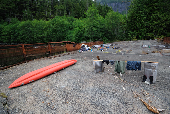
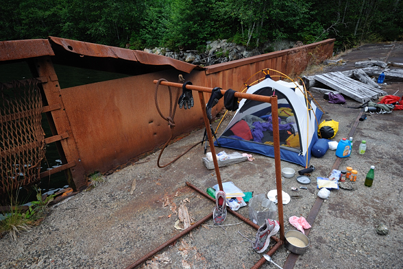
When I finally got my stuff to the grassy beach I had to pack it up quickly and set up my boat because there wasn’t much day left. I made two runs over to dump my stuff on the barge and filled up my water containers at the creek. I set up my tent, made dinner, and called it a day.
That had probably been the most physically difficult thing I have ever done in my life. I have done big mountain bike races before, riding 70 km through the mountains from Squamish to Whistler. But I was in better shape back then. And those races only went for a few hours. This went all day and I pushed my body to the limit. Whew! It was done. I checked my toe and the previous blister had worn away and the layer of skin beneath it had made a new blister, even larger. But there was little blood, thankfully. Even as I write this today, months later, I still have numbness on that part of my toe from the nerve damage. Now my concern was how my body was going to feel tomorrow and then, how I was going to get out. I would take a day off on the barge tomorrow and then plan to paddle back out the day after, camping at the empty logging camp I passed on the way in. I would probably try to ask for assistance in crossing over to Port Hardy if I could find it, since I decided that this was the best course of action. But I had no idea what that crossing entailed specifically, other than what the previous kayaker had said (the last person I had spoken to) – that it was windy and rough and not recommended for an inflatable kayak.
When I woke up the next morning my entire body ached. It was painful even to lift my arm. But after I got up and moved around a bit I loosened up. I was pleasantly surprised to see that my right knee tendonitis wasn’t exceptionally bad, which is amazing considering what I just put it through. It was of course very sore but I could still walk OK. I had soreness in muscles in my legs I hadn’t felt before. Everywhere hurt. You know, “the burn”.
Today I ate a lot of food; I had dinner for breakfast, dinner for lunch, and dinner for dinner, and I think I also had an extra dinner in there too. Lots of nice spicy food. Of course I ate lots of raw brown sugar too.
I watched seals playing, or fighting or mating or something, just off the barge. This is a productive inlet here with shallow water at its head. I was surprised that even here, so far from the ocean, the tidal range was still about four feet.
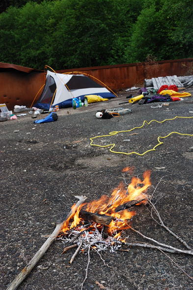
I made a fire which lifted my spirits. There was a lot of wood on the barge and it seems that previous people had done this too. It’s a great place to get off your boat if you come up the arm. It was disheartening to see a gallon jug of motor oil left there by someone. I don’t know how to get that out. I certainly didn’t have room.
I went to bed for the night and as it was getting dark I thought I could see flashes. I wondered if I was going crazy but yes, there was some lightning off in the distance. I didn’t hear any thunder so it was a ways away. It sprinkled a bit too.