I woke up to sunshine and calm winds! And lots of bugs. Along with my usual morning routine including collecting salal berries for my oatmeal I took advantage of the sun to set up my solar panel on a big stump to charge my GoPro camera. I also assessed all of my food supplies – two weeks’ worth, not including any fish I catch. This should be enough to get me to Rivers Inlet where apparently there is at least one floating general store in a bay somewhere, catering to the summer boating crowd. My map sucked, so I didn’t know exactly where it was but I’d figure it out.
This spot is beautiful, especially in the sunlight. It was reflecting off the water onto the cedar trees on the nearby shore and making interesting patterns, below a vibrant moon in a blue sky.


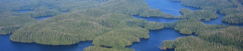
A little bit of morning marine layer

All my food


Because of the Narrows, there is very little garbage on the shores here. This was some bling left by birds. Probably a stolen lunch sandwich from some forestry operations.

I also noticed more of these hundreds of tiny fish which I had seen before a few times in the last few days. They were only in the inlet, this side of the Narrows. They were about a centimeter long and schooled by the thousands. I got out my fish net and scooped some out and saw that they were actually swimming mysid shrimp. If I cared to I could make a meal out of them, some stew or soup. Just scoop until I had enough.

The little shrimp were all around my kayak here.

That’s the floating house I would paddle by.

Logging operations a few years later. Alder grows on the disturbed soils of the roads.

Fresh logging with some soil disturbance

A variety of age classes. Above is old growth. Below this is relatively recent cutting and in the foreground is maturing second growth forest.
I still needed water so I’d hug the northwest shore as I paddled to see if any of the indentations on my map actually had water. I got as far as the northwest point of the inlet and at this point there is a valley with a creek. However, I had to hike a ways up the creek to get away from the salt water. I took video of this whole affair. I strapped the camera to my head and my audio recorder to my wrist and started hiking up the mud flat. I had to cross the creek once and I was thigh deep, walking across slippery boulders. If I fell I could destroy my audio recorder. Luckily I didn’t.
I felt uneasy walking up this creek because it is perfect bear habitat. I noted how much the vegetation reminded me of my home forests, the Seymour Valley in North Vancouver (not to be confused with the other nearby Seymour Inlet and River up here, they are totally different). I love exploring those verdant riverside forests in North Van but I also know that there are no grizzlies there; there would likely be some here.
I got to a point which obviously had fresh water so I filled up my new found water bottle from Shelter Bay. The grass beside this spot was flattened from something large, presumably sleeping. I returned to my kayak and filtered it, then went for another water run. That went by fine as well.

I had to hike into the trees a little farther than you can see here.
Then I decided to get some underwater video footage of the shrimp. They were in the brackish flow of the estuary by the hundreds of thousands. They seemed to be feeding off the bits of stuff flowing down the creek.

It’s interesting how different the marine life is in this inlet compared with the open ocean just outside the Narrows. That mostly has to do with salinity, especially in winter when huge volumes of rain and meltwater flood through the inlet and do not have a chance to flush well with the full strength sea water outside. It would be interesting to find out what the salinity is here in winter. As an interesting aside, there is an observation that all the natural fluids in the world have roughly the same proportions of elements. Rain water, fresh water, and sea water, they all have roughly the same composition of minerals. What is interesting is that the fluids of our bodies, like our blood plasma, have a very similar composition to sea water, with the exception of elements like nitrogen and phosphorus, but at only half the strength. This is why you can’t drink sea water. We have the same internal salinity as fish but they can drink sea water because they use energy to pump the excess salt out. This consistency is thought to be a relic of our primordeal origins as fish in the oceans; our bodies have maintained he same internal chemistry ever since.
I also noticed the lack of marine mammals in here; I can’t imagine any whales or dolphins coming through the Narrows. There were, however, plentiful seals because they are everywhere.

With that finished I continued on towards a logging camp a kilometer to the east. But as I was leaving I had divebombing displays from those gulls, which I think are mew gulls. They have the most beautiful, haunting, lonely calls. This one didn’t let up and got more aggressive as I got towards the floating house. I don’t know what it does when people are at this place. Maybe it is guarding the house for its owners. It probably had a nest around there somewhere. It got really aggressive and was bombing me repeatedly only a few feet above my head. I took photos of it but it was difficult to get good shots as it came in close because panning was hard. It went up over my head rather than from one side to the next.


Giving me the evil eye
The wind was picking up from the south so I was getting hit with some waves from the side as I went along. There was a large log boom perimeter protecting a calm area which is where the logs would be stored before being towed out. This was bouncing waves back at me. When I cleared this it got a little calmer. I crossed over to the south side of the inlet which was now going east, since that was in the lee of the wind.
There were more gulls here so I recorded their sounds and I’ll put them up when I finish writing the blog and figure out how to do it.

A normal gull on the big log with the smaller mew gull down below


Old logging near the head of the inlet


I think this clearing has to do with helicopter logging up above. I think they drop the logs here before towing them out.


I now had a long straight stretch to the final bend to the left which would be the end of my time on the water for a while. The paddling was uneventful in the sunshine with a nice tailwind. The mountains were getting higher. There was snow on some of them. At the end of a large island I crossed over to the north side before the inlet turned north. I spotted a murrelet nearby up against the shore and tried to get photos of it. It didn’t seem too scared of me but by the time I got my camera out it was gone.
I noticed on the other side of the inlet a picturesque waterfall cascading straight into the water, so I could have filled up my water there rather than at the previous creek. This creek must be fed from high elevation snowmelt since it was going pretty good. I wasn’t sure if I would have water at my pullout since the map showed a small stream but I didn’t know if it would be running.
I finally rounded the final corner and saw my adversary for the next few days. Or should I be more optimistic and call it my “friend”? I felt a bit of a lump in my throat. I just didn’t know how the next few days would go. The location was beautiful and sunny, and nice and warm with a light breeze.

Rounding the final corner. That is my pass up there. I say “mine” because it may not have ever been traversed before, I don’t know.
I also noticed some very large impassable cliffs which were not noted on Google Earth or my topo map. That’s OK though because I was going up the valley to the pass at the base of those cliffs. I still had to get to over 300 m elevation though.
There was an abandoned barge at the very head of the inlet near where I would enter the forest. The grassy spot beside the creek would be the best entry point. I was glad to see that the forest was no longer hypermaritime, which is an almost impenetrable tangle of thick brush. This forest was again more like what I was used to around Vancouver – a high closed canopy with relatively sparse understory vegetation. This is of course all relative. It is still very dense.


For some reason I wanted to make some headway today so rather than camping on the barge, I decided that it would be to dangerous to pull my kayak up against the rusty metal and instead packed up all my stuff to see how far I could get in the bush before dark. I had a couple hours left. The tide was coming in but I got it all sorted out and off I went.


I would do the portage in five loads, with one backpack full of little things that never leave the pack. All the remaining large items would be carried in my kayak backpack. I would fill and empty the pack with each run. I would go about 30 meters per run and then dump my stuff and come back for the next load. This would be five loads in total.
It doesn’t sound too bad and I convinced myself of that. It is only about 2.5 km across to Long Lake where I would then go down to Wycleese Lagoon and then exit into Smith Inlet, thereby bypassing Cape Caution. Well, when you consider that I had to return 4 times to get the additional loads, we can do some math and add it all up: 2.5 km times 5 for the loaded runs, plus 2.5 km times 4 for the return runs. That equals 22.5 km. And that is over rough terrain.
The first run crossed the creek and went up to a little bench above the creek. This continued on for a hundred meters or so. Then I crossed another little dry muddy creek and after this the incline started. It went up for another 100 meters, but it got steeper. I was taking comfort in that it was actually very reminiscent of the Grouse Grind in Vancouver which I used to do regularly and get very good times on. That is a 700 meter vertical climb up Grouse Mountain above Vancouver which is 2.9 km long I believe. It is basically just a huge staircase.
Based on that history I should have no problem with this bushwhack. The problem was that I was still recovering from severe patellar degeneration and tendonitis in my right leg from the nerve damage and all the damage the physiotherapist and doctors inflicted on me. And I was only in running shoes. I didn’t have space for more sturdy footwear.
Anyways, this day was a success. I did about four or five runs and near the top of this steep hill, I set up camp in a relatively flat spot. I went to sleep amidst the symphony of mosquitoes buzzing only inches from my head outside the mesh, wondering what the next few days would bring.

The forest is very similar to what you see on the Grouse Grind. Just substitute Sitka Spruce for Douglas-fir and everything else is the same.


