I got up as soon as it was light because today was going to be a long day. I wasn’t sure if I’d make it all the way to Port Hardy or not. That all depended on the weather. I would get to the islands in the middle of the Strait and reassess then.
The weather was calm and foggy and I packed up uneventfully despite the steep wet rocks leading down from my tent site, put on my drysuit and loaded up. Loading the kayak was a little tricky because of the slippery bedrock at low tide but the few patches of barnacles amongst the rockweed gave me enough grip. I set out and said goodbye to the starfish watching me load my boat from below.

I would have to use both my compass and my GPS. I did not know how long the batteries on my GPS would last so I did not want it on all the time. I would turn it on every once and a while to confirm my direction with what my compass was telling me, and I had to spend a few minutes practicing how to use it again. I was heading due south which should take me to the coordinate given to me yesterday: 50-54. That sounds kind of like the name of a band from Vancouver called 54-40. They are named after a political campaign from another age when Americans in Oregon wanted to push the northern boundary of the US up to the line 54 40. They didn’t succeed and it stayed at 49 degrees.
I have had various songs by 54-40 in my head for most of my trip and today I had Baby Ran which seemed appropriate.
I started videotaping my paddle soon after and within a few minutes I reached the end of the main island and where I would head out into the open water. I passed by another little island, then saw another little bird rock off in the distance, the final one. I went by and observed the birds and the waves breaking, and after this I entered the blind fog. I noticed that the batteries on my audio recorder had died so I turned off the video.

The danger here is that with the limited visibility a big ship could run me down without realizing it because I couldn’t see it coming and it couldn’t see me. I could hear a lot though because the wind was calm and the sound traveled far, but because of this it was hard to get an idea of how far away things were. Determining the direction of sounds wasn’t a problem, however; all along I had a foghorn off to my left which was probably coming from somewhere around Shelter Bay. This followed me for miles.
Once out in the open I could hear a large vessel approaching from the north-west. It was something fairly slow, but large. I kept my eye open and tried to judge its direction in relation to mine. After about twenty minutes it became apparent that it had passed behind me and I relaxed a bit. This northern channel is not the main waterway up the Strait thankfully.
There were regular visits from seabirds flying by and swimming around. I continued on for what have must been a good hour and a half, heading due south into the middle of nowhere. I had nothing to give me bearings except my navigation aids. Plus the foghorn, and the direction of swell. I noticed that if I didn’t keep an eye on the compass I would naturally turn into the swell which was coming from the north-west. As for my destination, all I had was the GPS coordinate to go on. The water was calm with rolling swell, and no winds. I wondered when I’d first see land.

My first hint wasn’t visual, but olfactory. I could smell bird guano and that told me I was coming up to something. Then I could make out small islands far off to the right.

There’s an island there if you look hard.
As I passed these I began to see more faint outlines of larger islands and eventually I came to the main one, Kent Island. The shoreline was confusing and I had no idea of the shape of these islands. I just kept heading in my general direction as long as the island would let me. I was getting pushed more to the southeast by the coastline.

Luckily the currents were going my direction, and I went past extensive kelp beds.

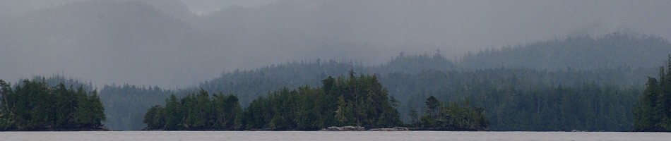
The pleasure boat traffic was fairly light and I eventually passed through a channel between this island and another large one to the east. I could hear oystercatchers here and I had wanted to get audio of them for a long time since they make the greatest noises. But now there was always the sound of some boat or plane in the background so there was no point. I stopped to take pictures of pigeon guillemots flying around and entering their nests on a little island. The nests are in the roots of the trees and salal just above the high tide line. The vegetation here is very luxuriant, with what seems like an impenetrable green understory of salal. Spruce manage to poke through it. This is hypermaritime forest, that’s for sure.


The pigeon guillemot island
There was a fish farm across this channel, and boat traffic picked up considerably here. The currents were all over the place. One minute I’d be going with them, then I’d round a point and suddenly I’d be fighting them.


I decided to keep moving and head for Port Hardy today because it was barely lunch time and the weather was still calm. When I reached the end of this island and saw a large crossing before me I took lunch by tying off to some kelp right at the edge of all the action. If I was looking for company a few days ago, well I found it. There were tons of boats here (well, relatively speaking). The fog was beginning to lift and a BC Ferry actually went through the channel up ahead of me, on its way up to Prince Rupert! This was a lucky sight because it doesn’t run often. This is not the Queen of the North, but its replacement which I do not know the name of. The Queen of the North sank a few years ago in the treacherous waters off Kitimat, beside Princes Royal Island which I plan to visit and cross (via a bushwhack…) when I resume my trip. The ferry hit some rocks and sank to the bottom, taking two lives with it. This is the exact same location where the Alberta oil companies (Enbridge) want to run oil super tankers (not just regular tankers) to take synthetic crude from a planned pipeline linking Alberta. And they are assuring us that this will be safe…. yet this same company has had numerous recent large pipeline spills across North America. Last summer they spilled 800,000 gallons in the Kalamazoo river in the US, at the same time that they were assuring us the pipeline would be safe.


I sat there eating my dates and peanut butter. A largish pleasure boat of some sort went by and left a stink of diesel which was shortly followed by an oil slick that lasted a few minutes and stunk to high heaven, and left gunk on my kayak. I don’t know how much they were leaking but it had to be noticeable on their fuel gauge.
After the oil slick washed away on the current to somewhere else I put my hand back in the water to wash off my knife and fingers, and made my own little oil slick of peanut butter. I think that’s a little more benign than diesel though. I started out again to cross the channel and spotted a large California sea lion off the bow. Then I turned around and noticed a sailboat coming up behind me, the Snow Goose! This is the boat that gave me the coordinate yesterday. They were watching out for me and were surprised at my fast time. We talked for a while and took photos of each other because it’s hard to take a picture of yourself in your boat when you are in it! Something I have noticed, paddling alone….. I could actually set up my tripod from shore and make this the last thing I pack up when I leave, and then come back for it after the timer or video has taken images of me leaving, but I normally bury my tripod in my pack to avoid getting salt spray on it. I tried packing it exposed once, way back in Blind Bay by Nelson Island, and I got salt all over the head which is not ideal treatment for metal equipment. I need a somewhat splash-proof bag to put it in, and then strap this outside my pack in my boat, which will make it much easier to head out after retrieving my tripod after the photo.
Anyways, we will send the photos to each other later on. They wrote down my email address but understandably I didn’t get theirs. We arranged to meet in town for dinner later on. They gave me directions to the best location for getting through the next set of islands and from there on to Port Hardy.

The visibility had really opened up and I could see over to Vancouver Island by now. I started crossing the channel but the going was slow. It was a deceptive five kilometers; it did not look so far. I went by a buoy and confirmed that I was fighting the current. Finally I got to the other side and took a break up against the shore of the islands. I had a Clif Bar. Actually, I think I had two (my last ones) since I knew I would have all the food I wanted later on. There were now more and more boats all over the place, little fishing speedboats.
I went through the channel between some islands and had fun riding the currents which were going my way. I went right by the steep rocky shoreline, on the inside of the kelp. That is a handy waterway that kayakers can take advantage of. Immediately off the shoreline there is no kelp because it dries up at low tide. And when you get too far away from the shoreline it is too deep for the kelp to get started (it needs light to grow). So kelp grows in a strip just off the shoreline. This creates a little waterway between the kelp and the shore that you can ride (during high tide), if the currents are going your way.
I took some video of this but of course no audio. Then suddenly I crossed a line and I was fighting the current again. I figured this would be the last opportunity to get some pictures of me in my boat so I set my GoPro camera to the timer so that it would take a photo of me every three seconds, then I got out my wildlife camera so I’d have pictures of me taking pictures.

Various barnacle and mussel species
I then started the next crossing, the final one, over to the big island. It was mid afternoon and the wind was starting to pick up. I had about six kilometers to go to round the final point into the big bay protecting Port Hardy. The wind was coming down the Strait, kind of from behind me, around four o’clock. This helped and I made good progress.

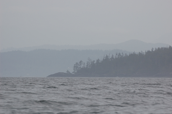
The final point before Port Hardy’s bay
It seemed to take a long time but I made it to the other side where there were tons of sport fishing boats milling around. I guess the sockeye were running. It was weird looking at people in their boats, they looked like they just came from watching TV in their living rooms and jumped in their boats to come out here and catch some fish. None paid any attention to me. A big cruise ship went by on the other side of the islands I just paddled through and I wanted to round the point before its wake caught me. Luckily I crossed the Strait before it came through.


Finally I made it around and then I saw that Port Hardy was still five kilometers down this bay. I saw some eagles eating fish on the rocks, probably discarded from fishing boats, and stopped to take photos, as well as of other shorebirds running around the barnacles above the waves. Interestingly, on one of the final paddle strokes with my bird lens out on my lap, I caught some kelp and it flicked water on my lens, on the focus ring. I swore and mopped it up but some probably got in behind. Now it happens …. in the final hour of my trip, I finally get some salt water on my cameras. I was planning on bringing it in for a cleaning anyways because earlier in the trip the focus ring seemed scratchy, probably from some fine sand getting underneath.


After this a fishing boat of some sort pulled up and pulled up its trap. The guy nodded at me. There were some nice protected cobble beaches here that would have made good camping spots but I couldn’t pass up the opportunity for a nice meal tonight.
I had a nice tailwind but those last five kilometers seemed to go on forever. On approaching the town I had to head east to avoid some shallow water and then I got to the main federal dock in the center of town.

I was experiencing culture shock again, I didn’t know what to do. There was so much going on. There were all these kids casting off the dock and I didn’t want one catching me. I went under to the other side and talked to an official looking guy about where to spend the night camping and he said that I should go farther down to the other side of town to the main marina and they would be able to tell me.

That’s what I did, another kilometer down the harbour. This marina was packed with boats, I’d never find the Snow Goose here. I tied up and walked up the ramp to the big tourism complex and called my mom from the pay phone. She seemed disappointed when I told her I was coming back; I think she was hoping she would be rid of me for longer. I went into the tackle shop and asked the guy at the counter about camping and he was enthusiastic about the campsite up the river. I’d just have to go up the estuary and the campsite was right on the riverbank up from there. I could just land my boat on the shore and walk up. The river had at least 10 feet of water so it would be no problem. That was good.
On my way out I saw the cleaning station for all the halibut, salmon and rockfish being caught all over the Strait. Wow, I couldn’t help but notice how wasteful that is. The amount of meat left behind on one of those halibut skeletons would stuff me for a whole day on my trip. I would have gone to great lengths to have that anywhere on my trip. There were big yelloweye rockfish skeletons in there too, they were all being thrown into big blue plastic totes. I don’t know what they do with that, hopefully it doesn’t go to the dump. That would make some good pet food or fertilizer. It was a bit depressing to see all these interesting fish thrown in there, especially since those rockfish species are in trouble, and those big yelloweye rockfish could easily be well over a hundred years old.
I returned to my kayak and made my way back out of the myriad lanes of the marina and headed up the estuary.

The shoreline became light industrial beside the highway. It was an unglorious treatment of a productive estuary but oh well, I guess no one paid much attention to those things back when the town was developing.
I got as far as I could and then it got too shallow. I could see the campsite a few hundred meters away but I couldn’t get there on this low tide. I was pissed off. Yeah sure, ten feet deep! What a waste of effort. I weighed my options and decided to hike my stuff across the gravel bars to where the river was deep enough to paddle up. So 15 minutes later I finally got across and paddled up to the campsite. I found a place I could land and hiked up to see the campsite. I couldn’t believe how small and cramped the spots were. And it was more of a trailer park than a campsite. Maybe I was spoiled from all the amazing places I had been camping in over the last few months, but there was no way I was paying money to camp there!

The campsite is that little bit of white you can see in the trees on the right. First I had to get there!
I got back into my kayak and humped my stuff back over to the ocean and went back into town. I was getting tired and frustrated. I just wanted somewhere to sleep. As I was leaving the estuary there were many salmon jumping around my boat, presumably sockeye which were waiting for the river levels to rise. That’s what all the boats were after I guess.
I fought my way back up to the main federal dock, against the wind, and passed a Dragon Boat full of women practicing their rowing. I landed on the dock and asked some people about where I could stay and one guy who was staying on his boat said he was just sleeping on his sailboat tied up right there. The harbour master didn’t seem to be collecting any money. He figured I could pitch my tent right on the dock. It seemed a little rough and exposed, and there were people everywhere as well as lights. But I pulled all my stuff onto the dock and went into town to get some food.
Port Hardy is an interestibg place. There are a lot of vacant buildings around. It seems like its boom times from forestry, mining and fishing have subsided, and Port McNeil has taken on a larger part of that role as well. But it retains a lot of community spirit as there are flags everywhere and there seems to be an effort to maintain the town center. Maybe I am just judging with big-city eyes, where every available square foot is allocated to some real estate scheme. But the town does seem to provide a picture of what to expect when economies inevitably stop growing — visibly boarded up, vacant businesses, something never seen in Vancouver for any significant length of time.
I walked around looking for a grocery store but didn’t find anything so I went into a convenience store and ended up buying a box of crackers and a big chocolate bar. Really healthy. Oh well, I deserved this after the last few weeks.
I returned to the dock and then had a chat with a native guy and his son who had emerged from their aluminum boat. I asked about camping on the dock and he didn’t mind. They had just come down from Prince Rupert and were here for the salmon run. I asked him about the weather up north in August and he said that it definitely can get stormy in August in the northern half and that it was probably not a good idea to risk it this late in the season. He talked about how rough Cape Caution can be too. So that made me feel better about my decision to call it quits. I thought I could instead return to Telegraph Cove and go on an organized grizzly tour up Knight Inlet, or paddle back to Robson Bight for a week. It was only a few hours away from my mom’s house by bus.
The first guy in the sailboat mentioned that the building right by the dock was abandoned and that there was an old parking lot behind it where I could camp; that seemed ideal. I waited until it got darker to set up but then up pulled the same fishing boat that had the guy who nodded at me earlier. It was a live rockfish boat. They catch the rockfish and keep them alive so they can fetch a higher price in the Vancouver seafood market. It was interesting watching them unload because every single fish was counted, by species. And there are a LOT of rockfish species up here. People think rock cod are rock cod but no, there are lots of different types. People don’t realize the diversity of marine life we have off our coast, and these are beautiful bright colourful fish, as bright as any tropical fish. It’s just that they live in cold pea soup so they don’t show as well as the tropical ones.
The fish were being counted by a contractor hired by the government to monitor these things. It’s amazing how many fish they had in those live wells. They just kept pulling them out. And rockfish have venomous dorsal spines (they are in the same family as the tropical lionfishes). These workers were picking them up with rubber gloves. I asked if they got stung and they said they have gotten used to it.
It was a little sad seeing all these rockfish coming out. I wondered how sustainable this fishery really is and if the monitoring is really being used to ensure that it is sustainable. Based on the history of politics in fisheries management in this country, probably not.
After this I went back to my tent and cooked up some food and went to sleep. It had been a big day with 40 km of paddling. I would see about getting the bus back home tomorrow.


